MyTopo
Archer City East Texas US Topo Map
Couldn't load pickup availability
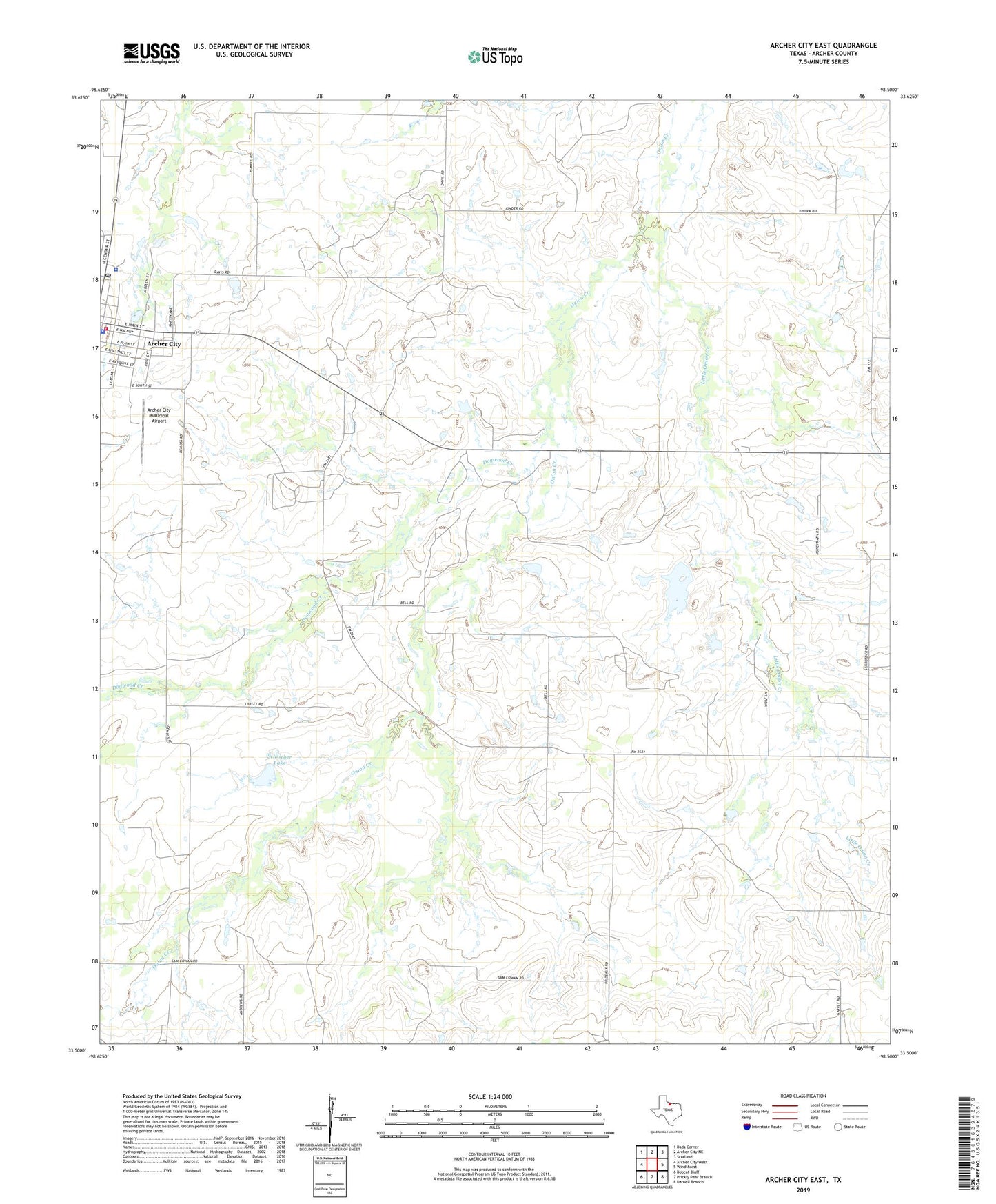
2022 topographic map quadrangle Archer City East in the state of Texas. Scale: 1:24000. Based on the newly updated USGS 7.5' US Topo map series, this map is in the following counties: Archer. The map contains contour data, water features, and other items you are used to seeing on USGS maps, but also has updated roads and other features. This is the next generation of topographic maps. Printed on high-quality waterproof paper with UV fade-resistant inks.
Quads adjacent to this one:
West: Archer City West
Northwest: Dads Corner
North: Archer City NE
Northeast: Scotland
East: Windthorst
Southeast: Darnell Branch
South: Prickly Pear Branch
Southwest: Bobcat Bluff
This map covers the same area as the classic USGS quad with code o33098e5.
Contains the following named places: Archer City Ambulance Service, Archer City City Hall, Archer City Division, Archer City Municipal Airport, Archer City Police Department, Archer City Post Office, Archer City Volunteer Fire Department, Archer County Jail, Archer County Sheriffs Office, Barbara Oil Field, Bell Oil Field, Demoss Northeast- Strawn Oil Field, Demoss- Strawn Oil Field, Dogwood Creek, Gore Oil Field, Jefferson Oil Field, King-Wilson Oil Field, Little Onion Creek, Moody Oil Field, North Archer City Oil Field, Schrieber Lake, Schrieber Lake Dam, Windthorst Oil Field