MyTopo
Windthorst Texas US Topo Map
Couldn't load pickup availability
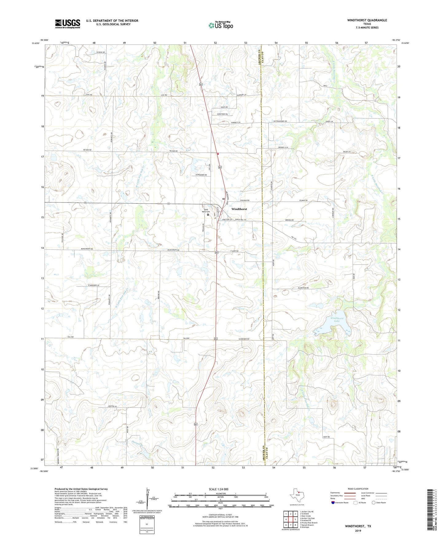
2022 topographic map quadrangle Windthorst in the state of Texas. Scale: 1:24000. Based on the newly updated USGS 7.5' US Topo map series, this map is in the following counties: Archer, Clay. The map contains contour data, water features, and other items you are used to seeing on USGS maps, but also has updated roads and other features. This is the next generation of topographic maps. Printed on high-quality waterproof paper with UV fade-resistant inks.
Quads adjacent to this one:
West: Archer City East
Northwest: Archer City NE
North: Scotland
Northeast: Deer Creek
East: Scotland SE
Southeast: Antelope
South: Darnell Branch
Southwest: Prickly Pear Branch
This map covers the same area as the classic USGS quad with code o33098e4.
Contains the following named places: Antelope Oil Field, Archer County Regular Oil Field, Bridwell Ranch, Saint Mary Cemetery, Scaling Oil Field, Town of Windthorst, Transcontinental Oil Field, Vieth Lake, Vieth Lake Dam, Windthorst, Windthorst Lake, Windthorst Lake Dam, Windthorst Post Office, Windthorst Volunteer Fire Department, ZIP Code: 76389