MyTopo
Seadrift Texas US Topo Map
Couldn't load pickup availability
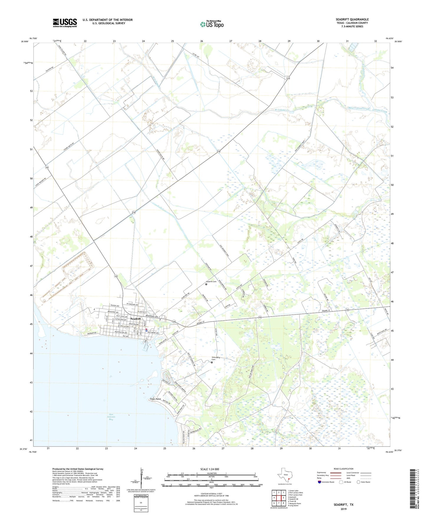
2019 topographic map quadrangle Seadrift in the state of Texas. Scale: 1:24000. Based on the newly updated USGS 7.5' US Topo map series, this map is in the following counties: Calhoun. The map contains contour data, water features, and other items you are used to seeing on USGS maps, but also has updated roads and other features. This is the next generation of topographic maps. Printed on high-quality waterproof paper with UV fade-resistant inks.
Quads adjacent to this one:
West: Austwell
Northwest: Green Lake
North: Port Lavaca West
Northeast: Port Lavaca East
East: Seadrift NE
Southeast: Long Island
South: Mosquito Point
Southwest: Tivoli SE
Contains the following named places: City of Seadrift, East Coloma Creek, Long Mott Oil Field, Roemerville School, Seadrift, Seadrift Cemetery, Seadrift City Hall, Seadrift Elementary School, Seadrift Fire and Emergency Services, Seadrift Police Department, Seadrift Post Office, Stiernberg Cemetery, Swan Point, Swan Point Park, West Coloma Creek