MyTopo
Shafter Texas US Topo Map
Couldn't load pickup availability
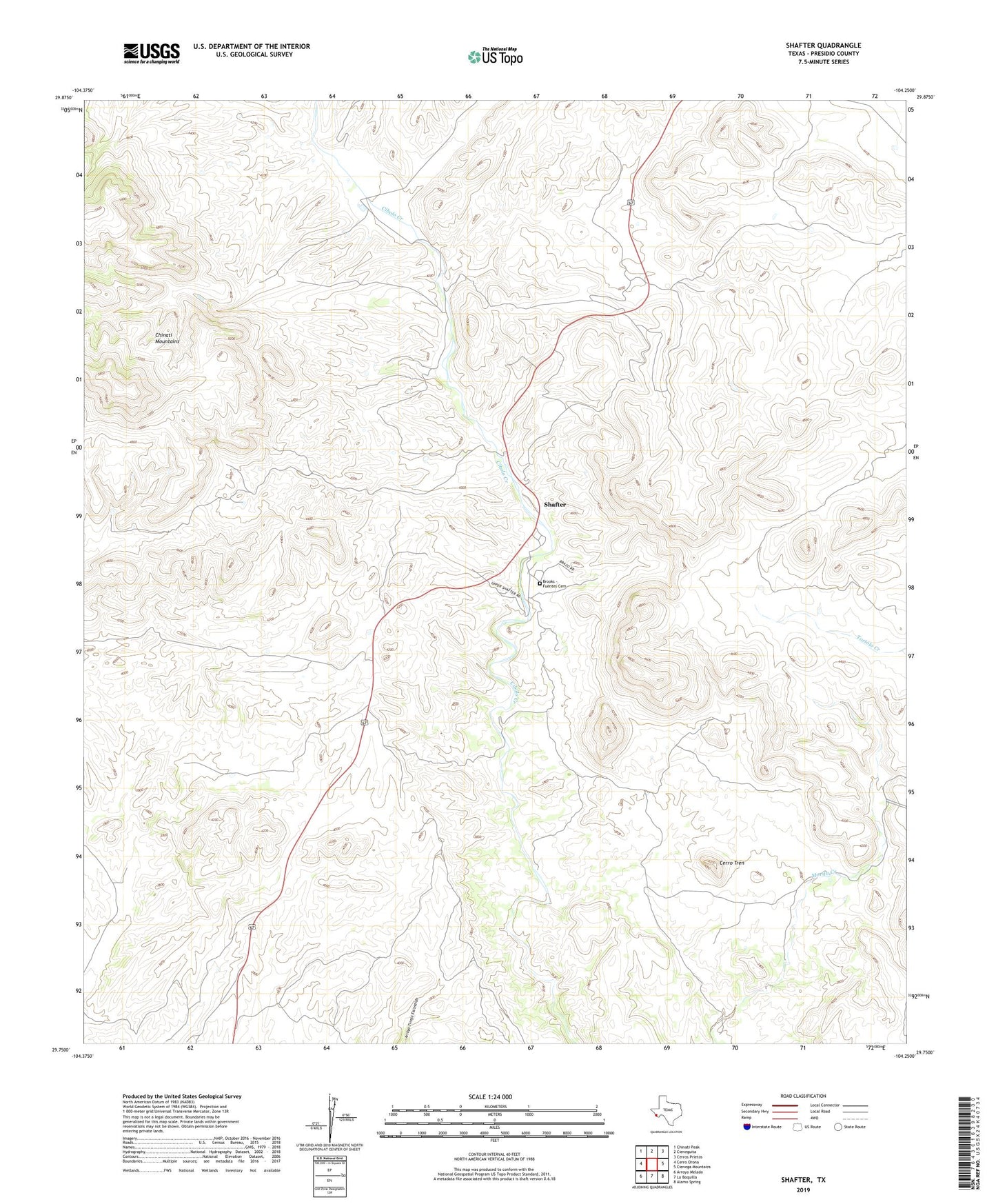
2022 topographic map quadrangle Shafter in the state of Texas. Scale: 1:24000. Based on the newly updated USGS 7.5' US Topo map series, this map is in the following counties: Presidio. The map contains contour data, water features, and other items you are used to seeing on USGS maps, but also has updated roads and other features. This is the next generation of topographic maps. Printed on high-quality waterproof paper with UV fade-resistant inks.
Quads adjacent to this one:
West: Cerro Orona
Northwest: Chinati Peak
North: Cieneguita
Northeast: Cerros Prietos
East: Cienega Mountains
Southeast: Alamo Spring
South: La Boquilla
Southwest: Arroyo Melado
This map covers the same area as the classic USGS quad with code o29104g3.
Contains the following named places: Brooks - Fuentes Cemetery, Cerro Tren, Concordia Cemetery, El Fortin del Cibolo Historic District, La Morita Historic District, Shafter, Shafter Historic Mining District, Shafter Mine