MyTopo
Chinati Peak Texas US Topo Map
Couldn't load pickup availability
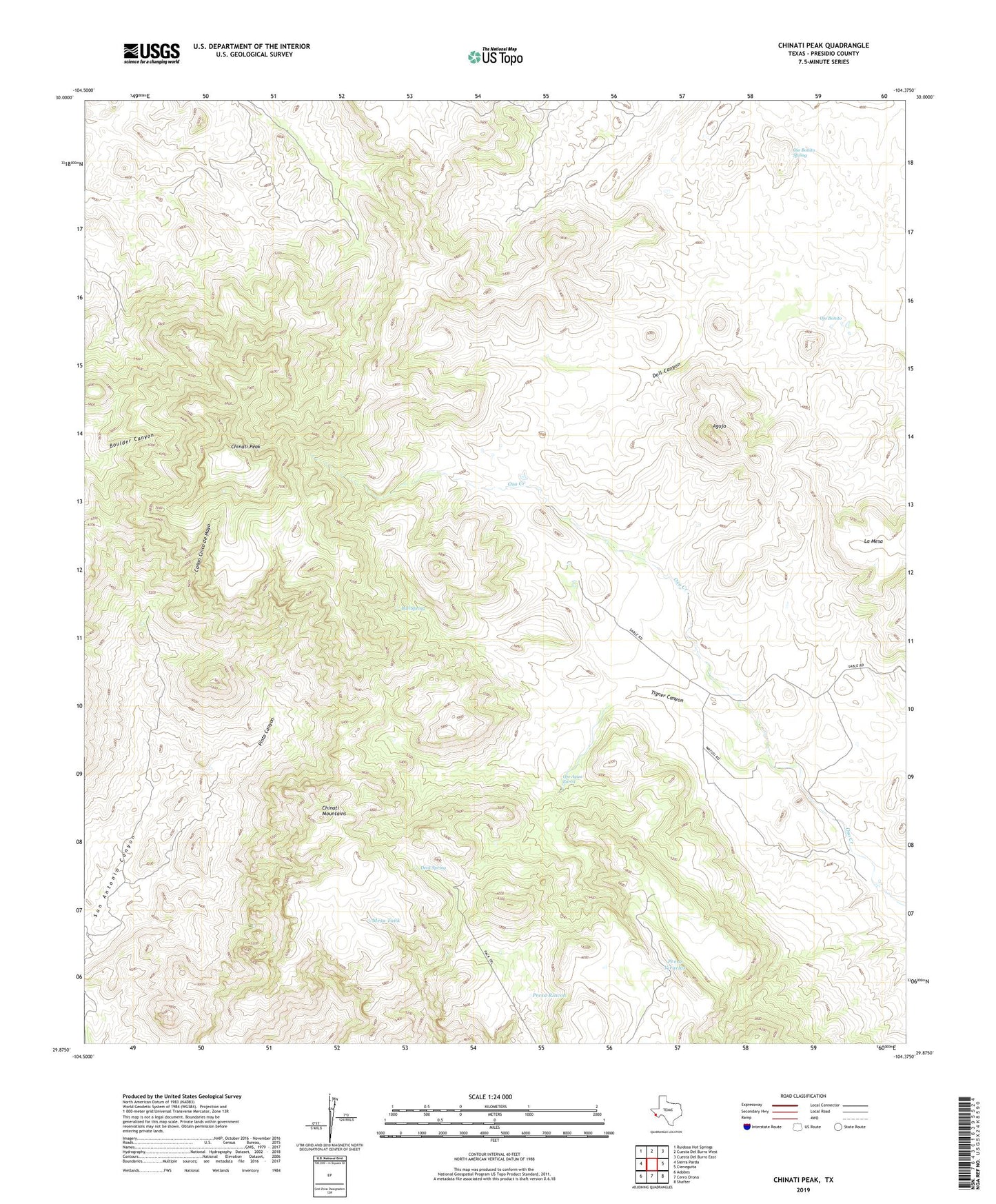
2022 topographic map quadrangle Chinati Peak in the state of Texas. Scale: 1:24000. Based on the newly updated USGS 7.5' US Topo map series, this map is in the following counties: Presidio. The map contains contour data, water features, and other items you are used to seeing on USGS maps, but also has updated roads and other features. This is the next generation of topographic maps. Printed on high-quality waterproof paper with UV fade-resistant inks.
Quads adjacent to this one:
West: Sierra Parda
Northwest: Ruidosa Hot Springs
North: Cuesta Del Burro West
Northeast: Cuesta Del Burro East
East: Cieneguita
Southeast: Shafter
South: Cerro Orona
Southwest: Adobes
This map covers the same area as the classic USGS quad with code o29104h4.
Contains the following named places: Aguja, Bull Spring, Canon Cinco de Mayo, Chaffin Place, Chinati Mountains, Chinati Peak, Deck Spring, Doll Canyon, La Mesa, Mesa Tank, Ojo Agua Zarca, Ojo Bonito, Ojo Bonito Spring, Pinto Canyon, Presa Llorona, Presa Rincon, Presa Viruelas, San Antonio Mine, Tigner Canyon, Wood Ranch