MyTopo
Sierra Madera NE Texas US Topo Map
Couldn't load pickup availability
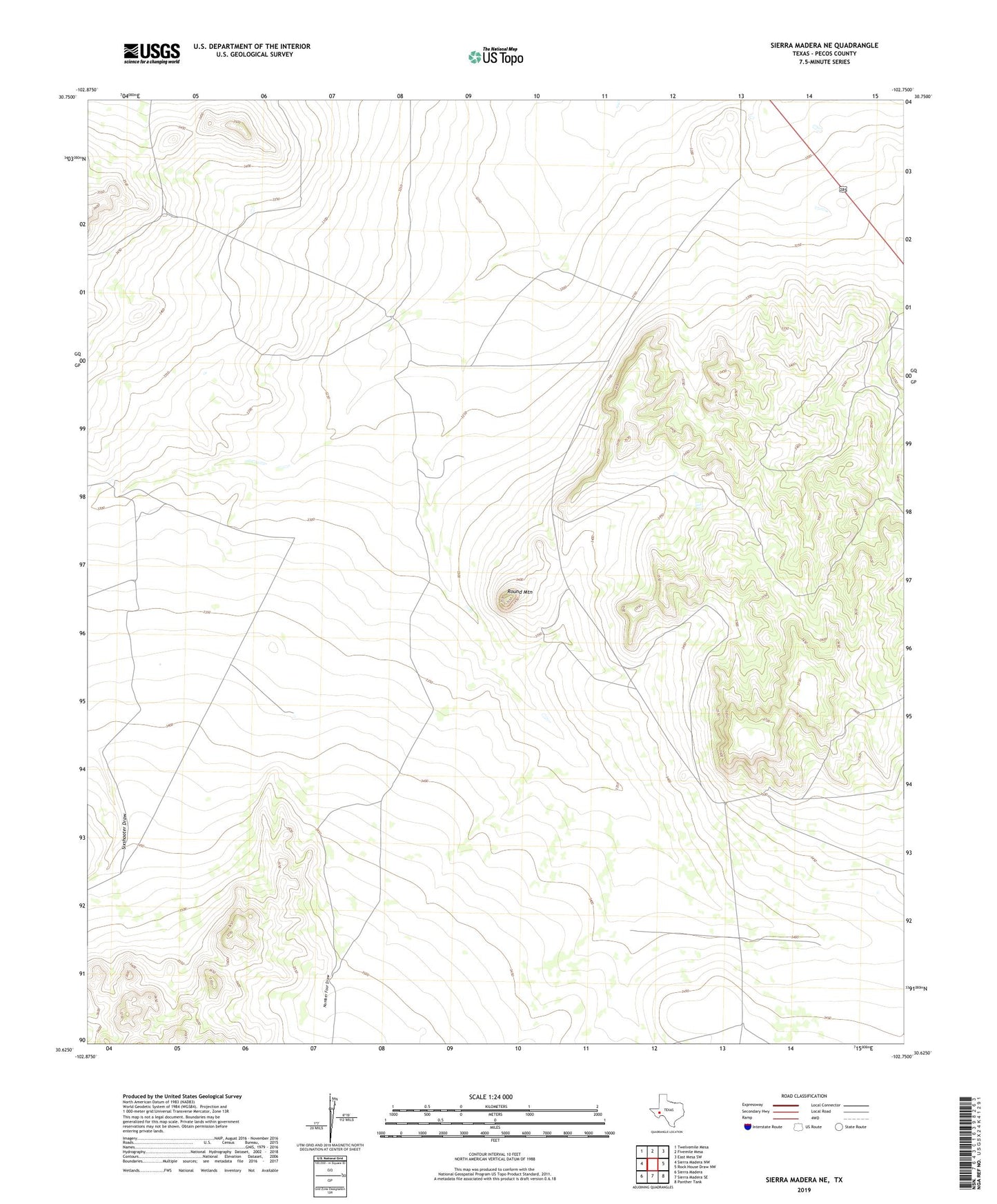
2022 topographic map quadrangle Sierra Madera NE in the state of Texas. Scale: 1:24000. Based on the newly updated USGS 7.5' US Topo map series, this map is in the following counties: Pecos. The map contains contour data, water features, and other items you are used to seeing on USGS maps, but also has updated roads and other features. This is the next generation of topographic maps. Printed on high-quality waterproof paper with UV fade-resistant inks.
Quads adjacent to this one:
West: Sierra Madera NW
Northwest: Twelvemile Mesa
North: Fivemile Mesa
Northeast: East Mesa SW
East: Rock House Draw NW
Southeast: Panther Tank
South: Sierra Madera SE
Southwest: Sierra Madera
This map covers the same area as the classic USGS quad with code o30102f7.
Contains the following named places: Dry Windmill, Fort Stockton Division, Kelly Wade Windmill, Lemon Windmill Number One, Lemonds New Windmill, Little Windmill, Middle Windmill, North Windmill, Number Four Draw, Red Well, Round Mountain, Round Mountain Windmill, Sixshooter Windmill, Twenty Foot Windmill, Weak Windmill, ZIP Code: 79735