MyTopo
Skellytown Texas US Topo Map
Couldn't load pickup availability
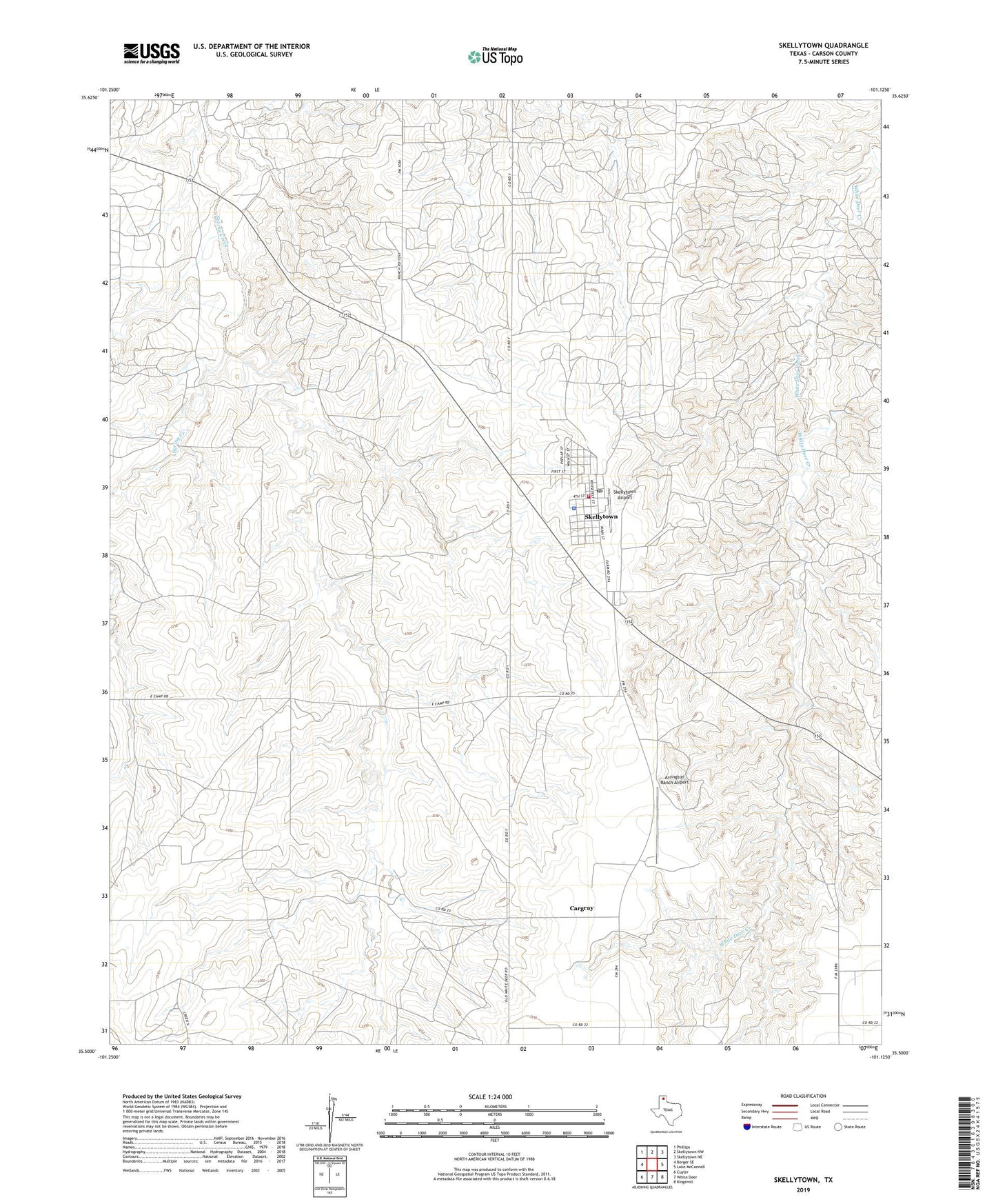
2022 topographic map quadrangle Skellytown in the state of Texas. Scale: 1:24000. Based on the newly updated USGS 7.5' US Topo map series, this map is in the following counties: Carson. The map contains contour data, water features, and other items you are used to seeing on USGS maps, but also has updated roads and other features. This is the next generation of topographic maps. Printed on high-quality waterproof paper with UV fade-resistant inks.
Quads adjacent to this one:
West: Borger SE
Northwest: Phillips
North: Skellytown NW
Northeast: Skellytown NE
East: Lake McConnell
Southeast: Kingsmill
South: White Deer
Southwest: Cuyler
This map covers the same area as the classic USGS quad with code o35101e2.
Contains the following named places: Arrington Ranch Airport, Cargray, Shaefer Ranch, Skellytown, Skellytown Airport, Skellytown City Hall, Skellytown City Marshal's Office, Skellytown Elementary School, Skellytown Fire Department, Skellytown Police Department, Skellytown Post Office, Town of Skellytown