MyTopo
South Bosque Texas US Topo Map
Couldn't load pickup availability
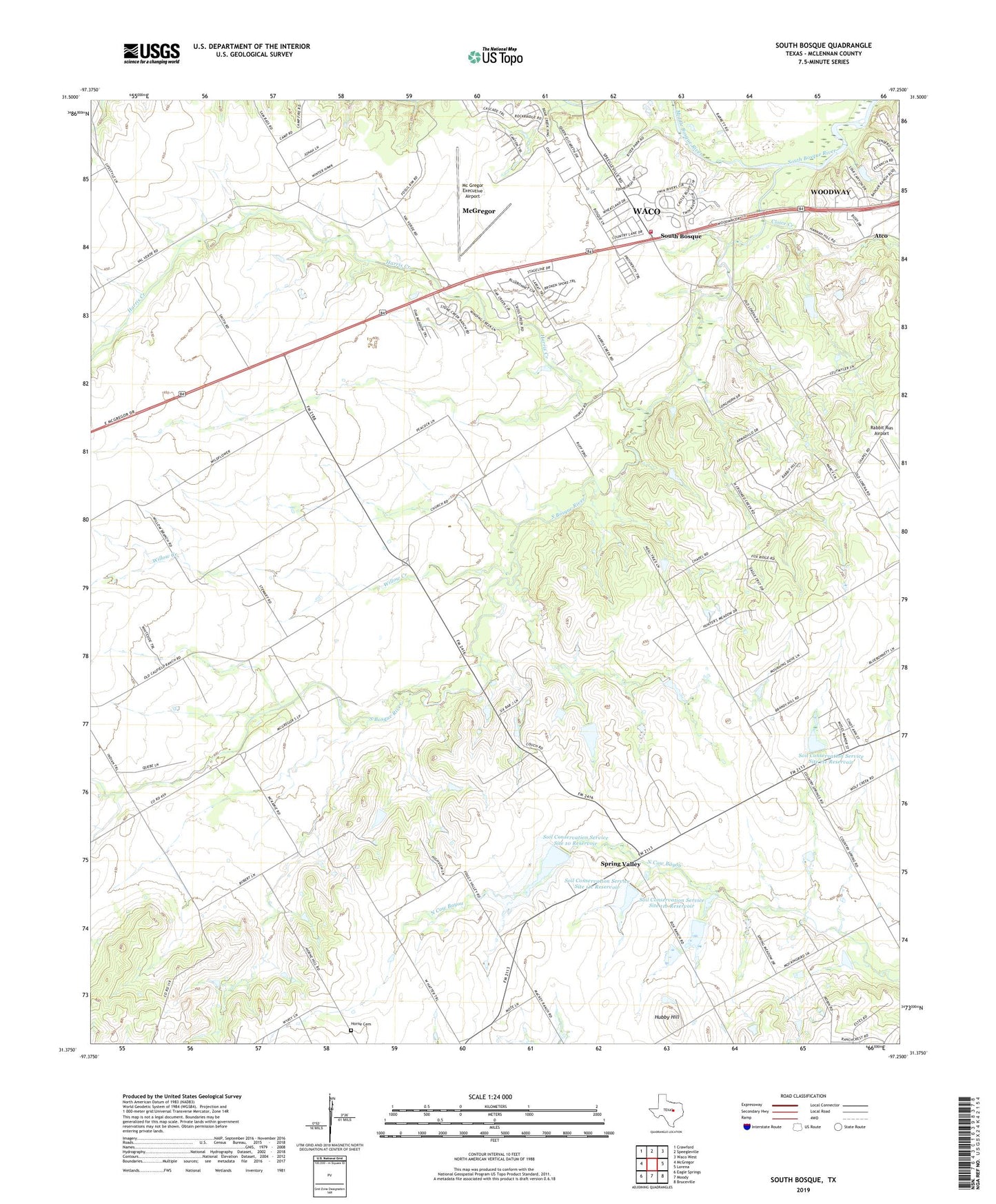
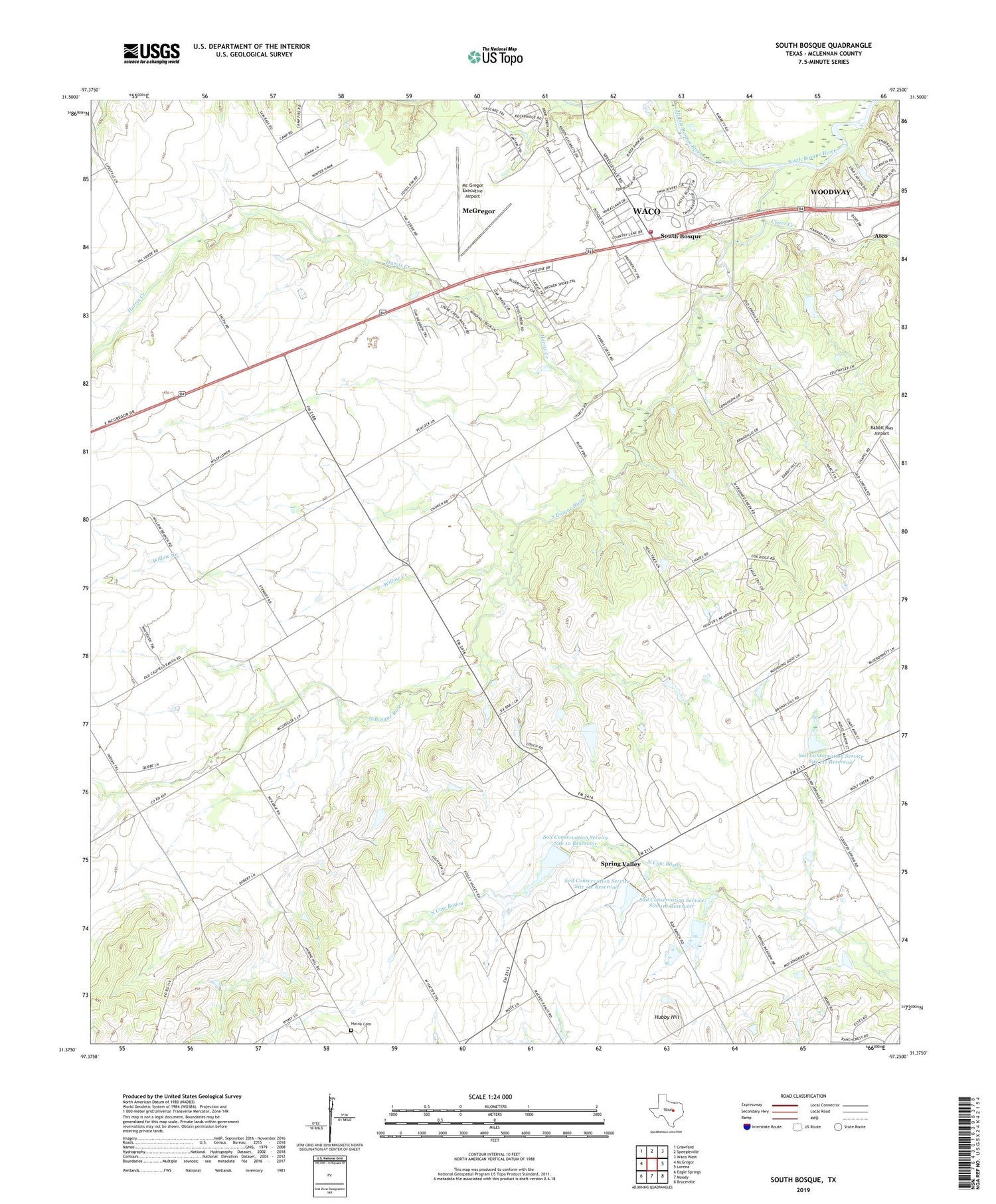
2019 topographic map quadrangle South Bosque in the state of Texas. Scale: 1:24000. Based on the newly updated USGS 7.5' US Topo map series, this map is in the following counties: McLennan. The map contains contour data, water features, and other items you are used to seeing on USGS maps, but also has updated roads and other features. This is the next generation of topographic maps. Printed on high-quality waterproof paper with UV fade-resistant inks.
Quads adjacent to this one:
West: McGregor
Northwest: Crawford
North: Speegleville
Northeast: Waco West
East: Lorena
Southeast: Bruceville
South: Moody
Southwest: Eagle Springs
Contains the following named places: Cloice Creek, Eagle Nest Airport, Harris Creek, Harris Creek Baptist Church, Harris Creek Church, Hog Creek Wildlife Management Area, Horne Cemetery, Hubby Hill, Kunze Lake, Kunze Lake Dam, McGregor Executive Airport, Middle Bosque River, Soil Conservation Service Site 10 Dam, Soil Conservation Service Site 10 Reservoir, Soil Conservation Service Site 11b Dam, Soil Conservation Service Site 11b Reservoir, Soil Conservation Service Site 11c Dam, Soil Conservation Service Site 11c Reservoir, Soil Conservation Service Site 11e Dam, Soil Conservation Service Site 11e Reservoir, South Bosque, Spring Valley, Waco Fire Department Station 14, Willow Creek