MyTopo
McGregor Texas US Topo Map
Couldn't load pickup availability
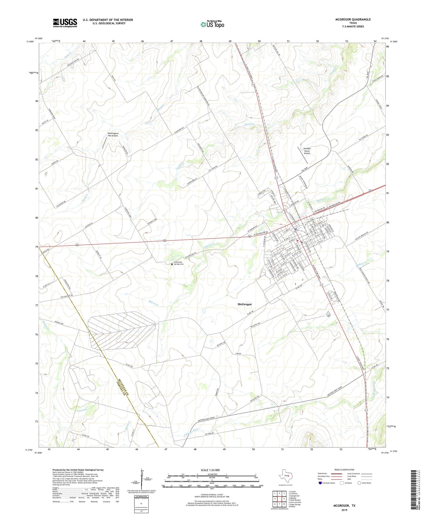
2022 topographic map quadrangle McGregor in the state of Texas. Scale: 1:24000. Based on the newly updated USGS 7.5' US Topo map series, this map is in the following counties: McLennan, Coryell. The map contains contour data, water features, and other items you are used to seeing on USGS maps, but also has updated roads and other features. This is the next generation of topographic maps. Printed on high-quality waterproof paper with UV fade-resistant inks.
Quads adjacent to this one:
West: Oglesby
Northwest: Coryell
North: Crawford
Northeast: Speegleville
East: South Bosque
Southeast: Moody
South: Eagle Springs
Southwest: Leon Junction
This map covers the same area as the classic USGS quad with code o31097d4.
Contains the following named places: Amsler Park, Bluebonnet Park, Brown-Mann House, Church of God, City of McGregor, College Avenue Baptist Church, Comanche Springs Cemetery, First Baptist Church of McGregor, Havelka Haven Airport, Isbill Junior High School, Isbill School, Kasting Park, Mc Gregor United Pentecostal Church, McGregor, McGregor Church of Christ, McGregor Division, McGregor High School, McGregor Police Department, McGregor Post Office, McGregor Prep High School, McGregor Volunteer Emergency Medical Service, McGregor Volunteer Fire Department, McLennan County Constable's Office Precinct 5, Mockingbird Hill Airport, Oglesby Park, Pleasant Hill Baptist Church, Roberson Chapel African Methodist Episcopal Church, T H Jenkins Elementary School, T H Jenkins School, Texas A and M University Research Center, Texas Forest Service - McGregor Office, Zion Lutheran Church of McGregor, ZIP Code: 76657