MyTopo
Eagle Springs Texas US Topo Map
Couldn't load pickup availability
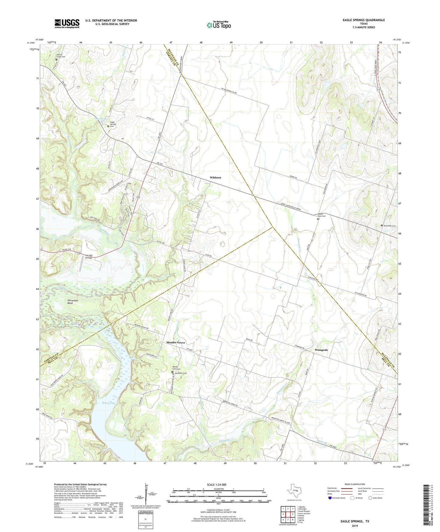
2022 topographic map quadrangle Eagle Springs in the state of Texas. Scale: 1:24000. Based on the newly updated USGS 7.5' US Topo map series, this map is in the following counties: Bell, Coryell, McLennan. The map contains contour data, water features, and other items you are used to seeing on USGS maps, but also has updated roads and other features. This is the next generation of topographic maps. Printed on high-quality waterproof paper with UV fade-resistant inks.
Quads adjacent to this one:
West: Leon Junction
Northwest: Oglesby
North: McGregor
Northeast: South Bosque
East: Moody
Southeast: Troy
South: Moffat
Southwest: Bland
This map covers the same area as the classic USGS quad with code o31097c4.
Contains the following named places: Alexander Cemetery, Brewster Creek, Buckhorn Cemetery, Eagle Springs, Eagle Springs Cemetery, Horseshoe Bend, Horseshoe Bend Wildlife Management Area, Iron Bridge Park, Iron Bridge Wildlife Management Area, Meador Grove, Moody-Leon Cemetery, Moody-Leon Church, Mother Neff Church, Mother Neff State Park, Mother Neff State Park Trail, Mount Zion Cemetery, Onion Creek, Payne Branch, Stampede, Station Creek, Station Creek Cemetery, Stockton Chapel, Tick Hill Airfield, Whitson, ZIP Code: 76557