MyTopo
Stanton Texas US Topo Map
Couldn't load pickup availability
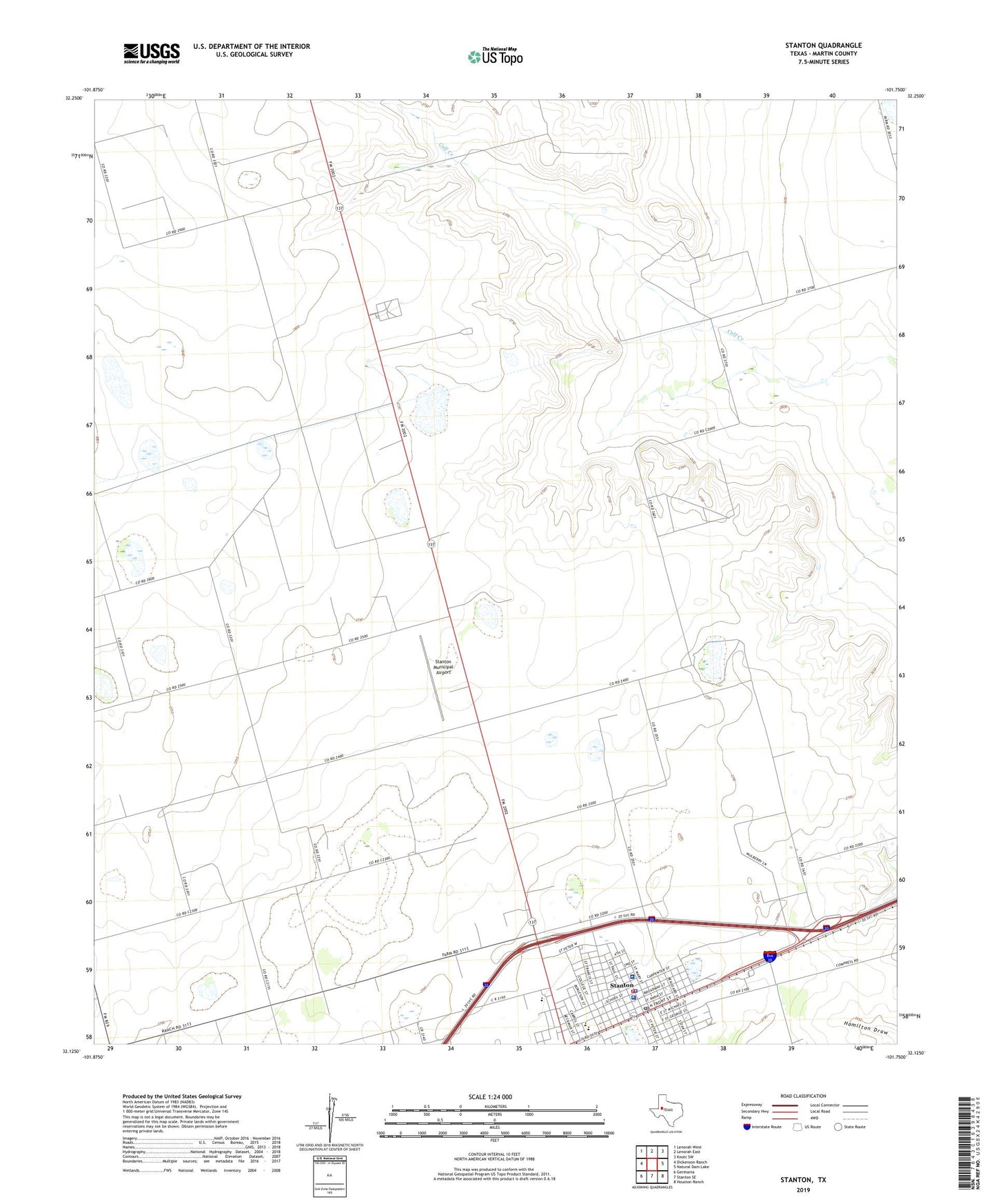
2022 topographic map quadrangle Stanton in the state of Texas. Scale: 1:24000. Based on the newly updated USGS 7.5' US Topo map series, this map is in the following counties: Martin. The map contains contour data, water features, and other items you are used to seeing on USGS maps, but also has updated roads and other features. This is the next generation of topographic maps. Printed on high-quality waterproof paper with UV fade-resistant inks.
Quads adjacent to this one:
West: Dickenson Ranch
Northwest: Lenorah West
North: Lenorah East
Northeast: Knott SW
East: Natural Dam Lake
Southeast: Houston Ranch
South: Stanton SE
Southwest: Germania
This map covers the same area as the classic USGS quad with code o32101b7.
Contains the following named places: City of Stanton, Martin County Emergency Medical Service Ambulance Substation, Martin County Hospital District, Martin County Jail, Martin County Sheriff's Office, Permian Basin Encampment, Saint Joseph Cemetery, Shelbourne Park, Stanton, Stanton City Hall, Stanton Division, Stanton Elementary School, Stanton Municipal Airport, Stanton Police Department, Stanton Post Office, Stanton Volunteer Fire Department, Tommy Walker Memorial Park, ZIP Code: 79782