MyTopo
Sterley Texas US Topo Map
Couldn't load pickup availability
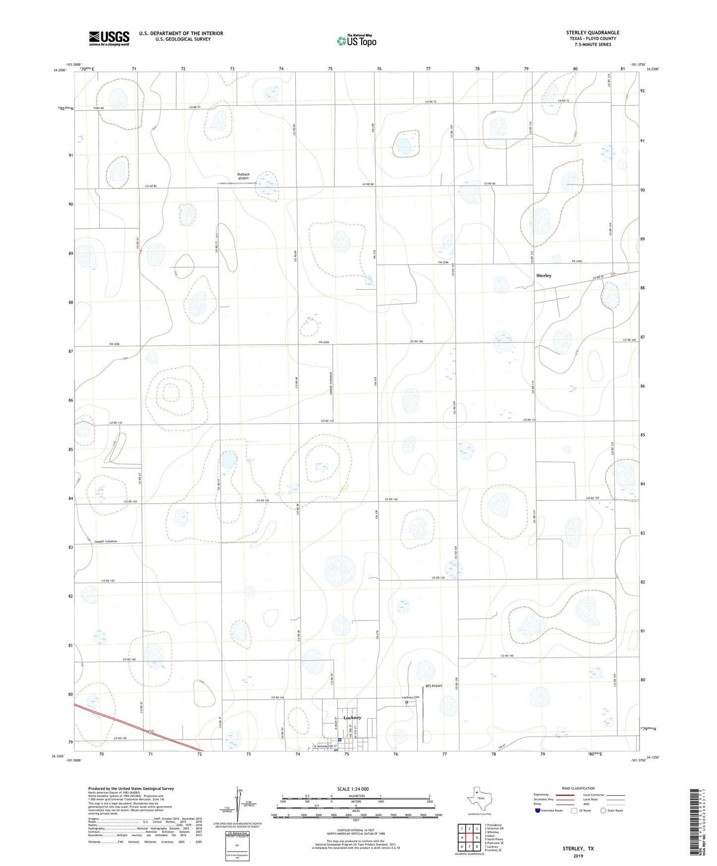
2022 topographic map quadrangle Sterley in the state of Texas. Scale: 1:24000. Based on the newly updated USGS 7.5' US Topo map series, this map is in the following counties: Floyd. The map contains contour data, water features, and other items you are used to seeing on USGS maps, but also has updated roads and other features. This is the next generation of topographic maps. Printed on high-quality waterproof paper with UV fade-resistant inks.
Quads adjacent to this one:
West: Aiken
Northwest: Providence
North: Silverton SW
Northeast: Whiteley
East: South Plains
Southeast: Lockney SE
South: Lockney
Southwest: Plainview SE
This map covers the same area as the classic USGS quad with code o34101b4.
Contains the following named places: BFS Airport, Lockney Cemetery, Lockney Post Office, Outback Airport, Prairie Chapel School, Sterley, W J Mangold Memorial Hospital, ZIP Code: 79241