MyTopo
Stockard Texas US Topo Map
Couldn't load pickup availability
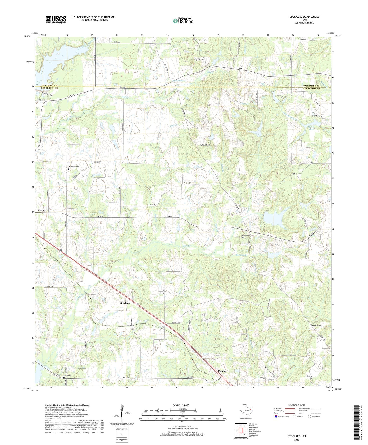
2019 topographic map quadrangle Stockard in the state of Texas. Scale: 1:24000. Based on the newly updated USGS 7.5' US Topo map series, this map is in the following counties: Henderson, Van Zandt. The map contains contour data, water features, and other items you are used to seeing on USGS maps, but also has updated roads and other features. This is the next generation of topographic maps. Printed on high-quality waterproof paper with UV fade-resistant inks.
Quads adjacent to this one:
West: Mabank
Northwest: Prairieville
North: Phalba
Northeast: Martins Mill
East: Murchison West
Southeast: Athens
South: Mallard Hill
Southwest: Malakoff
Contains the following named places: Big Rock, Big Rock Top, Briar Creek, Chinquapin Cemetery, Cottonwood Cemetery, Cottonwood Church, Eureka School, Fly-In-Lake, Fly-In-Lake Dam, Helms Branch, Melton Rock, Moorehead Cemetery, Mount Moriah Church, Payne Cemetery, Pickens, Purtis Creek State Park, Purtis Creek State Park Trail, Red Oak Branch, Roher Springs, Sand Flat Cemetery, Stockard, Thomas Lake, Thomas Lake Dam, ZIP Code: 75124