MyTopo
Structure Texas US Topo Map
Couldn't load pickup availability
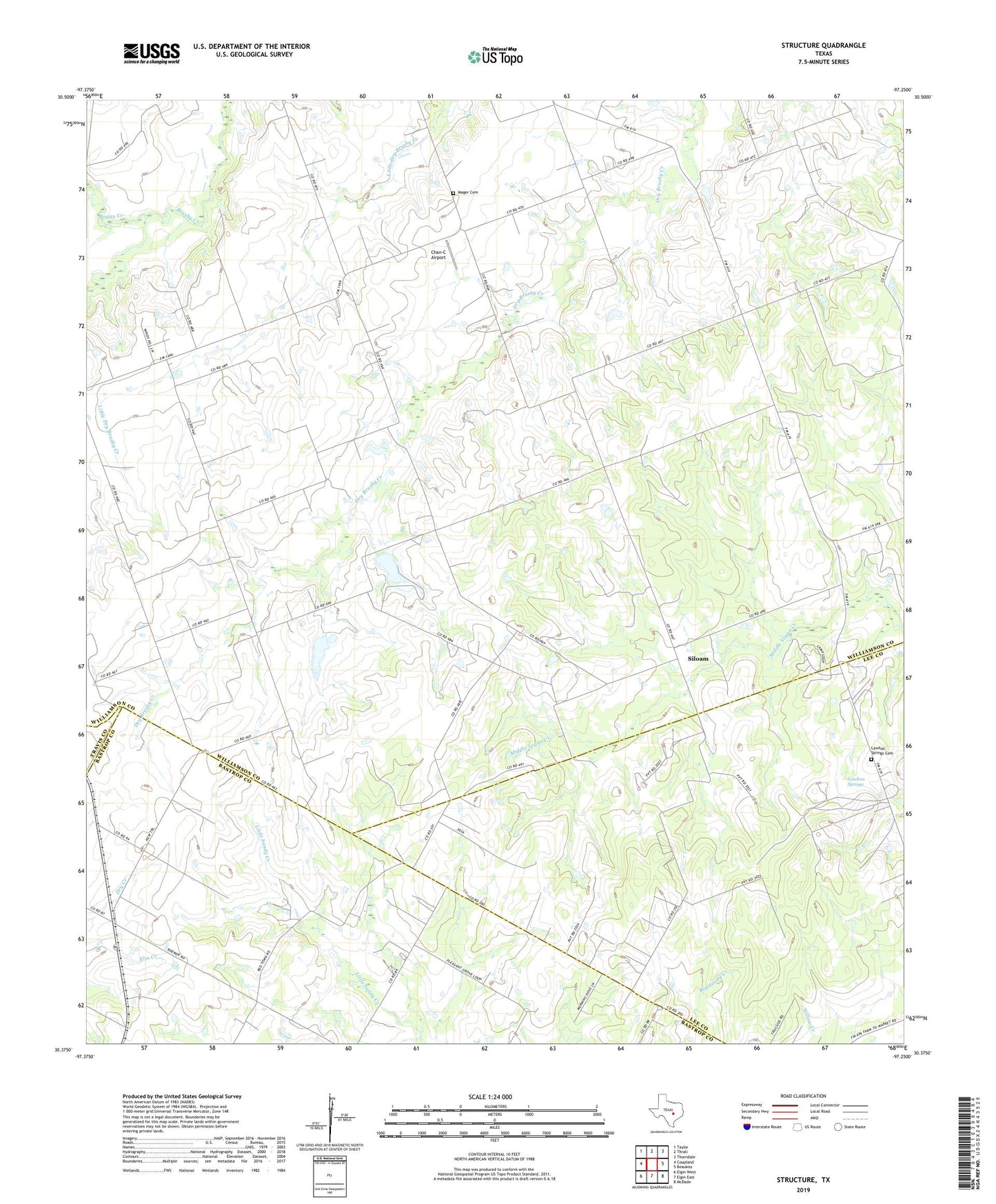
2019 topographic map quadrangle Structure in the state of Texas. Scale: 1:24000. Based on the newly updated USGS 7.5' US Topo map series, this map is in the following counties: Williamson, Lee, Bastrop, Travis. The map contains contour data, water features, and other items you are used to seeing on USGS maps, but also has updated roads and other features. This is the next generation of topographic maps. Printed on high-quality waterproof paper with UV fade-resistant inks.
Quads adjacent to this one:
West: Coupland
Northwest: Taylor
North: Thrall
Northeast: Thorndale
East: Beaukiss
Southeast: McDade
South: Elgin East
Southwest: Elgin West
Contains the following named places: Barton Field, Boggy Creek, Chan-C Airport, Lawhon Springs, Lawhon Springs Cemetery, Lawhon Springs School, Mager Cemetery, Pleasant Grove, Pleasant Grove School, Red Town School, Siloam, Soil Conservation Service Site 12 Dam, Soil Conservation Service Site 12 Reservoir, Soil Conservation Service Site 13 Dam, Soil Conservation Service Site 13 Reservoir, Structure, Sundbeck Ranch Airport, Type, Type Church