MyTopo
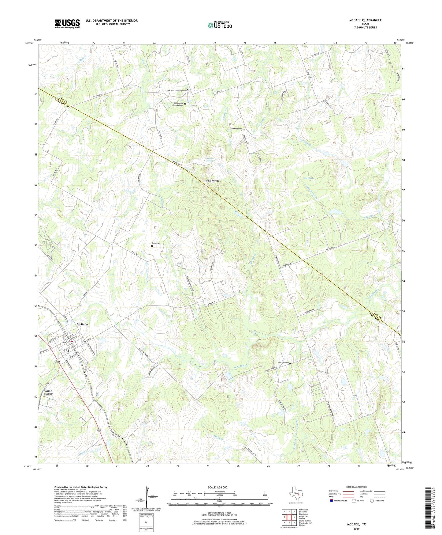
McDade Texas US Topo Map
Couldn't load pickup availability
2022 topographic map quadrangle McDade in the state of Texas. Scale: 1:24000. Based on the newly updated USGS 7.5' US Topo map series, this map is in the following counties: Bastrop, Lee. The map contains contour data, water features, and other items you are used to seeing on USGS maps, but also has updated roads and other features. This is the next generation of topographic maps. Printed on high-quality waterproof paper with UV fade-resistant inks.
Quads adjacent to this one:
West: Elgin East
Northwest: Structure
North: Beaukiss
Northeast: Lexington
East: Fedor
Southeast: Paige
South: Smithville NW
Southwest: Lake Bastrop
This map covers the same area as the classic USGS quad with code o30097c2.
Contains the following named places: Dube Cemetery, Gum Spring, Gum Spring Branch, High Hill Cemetery, High Hill Church, Knobbs Springs, Marshy Branch, McDade, McDade Census Designated Place, McDade Post Office, McDade Volunteer Fire Department, Mid Springs Creek, New Knobbs Springs Cemetery, Old Knobbs Springs Cemetery, Paint Creek, Roanoke Public Library, Rocky Creek, Sanders Cemetery, The Knobbs, Yegua Knobbs, ZIP Code: 78650