MyTopo
Elgin West Texas US Topo Map
Couldn't load pickup availability
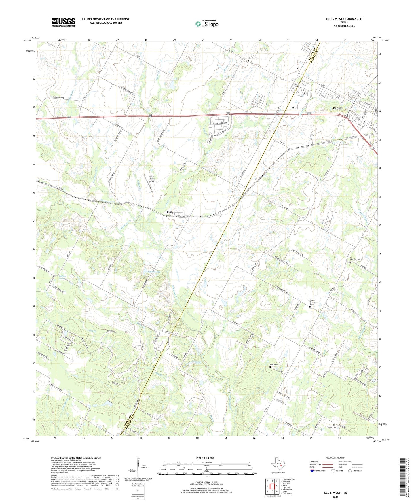
2022 topographic map quadrangle Elgin West in the state of Texas. Scale: 1:24000. Based on the newly updated USGS 7.5' US Topo map series, this map is in the following counties: Travis, Bastrop. The map contains contour data, water features, and other items you are used to seeing on USGS maps, but also has updated roads and other features. This is the next generation of topographic maps. Printed on high-quality waterproof paper with UV fade-resistant inks.
Quads adjacent to this one:
West: Manor
Northwest: Pflugerville East
North: Coupland
Northeast: Structure
East: Elgin East
Southeast: Lake Bastrop
South: Utley
Southwest: Webberville
This map covers the same area as the classic USGS quad with code o30097c4.
Contains the following named places: Baker's Place Airport, Bastrop County Constable's Office Precinct 4, Church of Christ, City of Elgin, Cornerstone Baptist Church, Cottonwood Creek, Dry Creek, Elgin Elementary School, Elgin High School, Elgin Primary School, Elm Creek, Elm Grove School, Evangelical Free Church, Harris Branch, Hog Eye Cemetery, Kimbro School, Littig, Pentecostal Church, Phoenix High School, Schiller Cemetery, Sellers Lake, Sellers Lake Dam, Speir Cemetery, Union Lee Church, Wilbern Spring, Willow Creek, Wilson Cemetery, Youngs Prairie Cemetery