MyTopo
Elgin East Texas US Topo Map
Couldn't load pickup availability
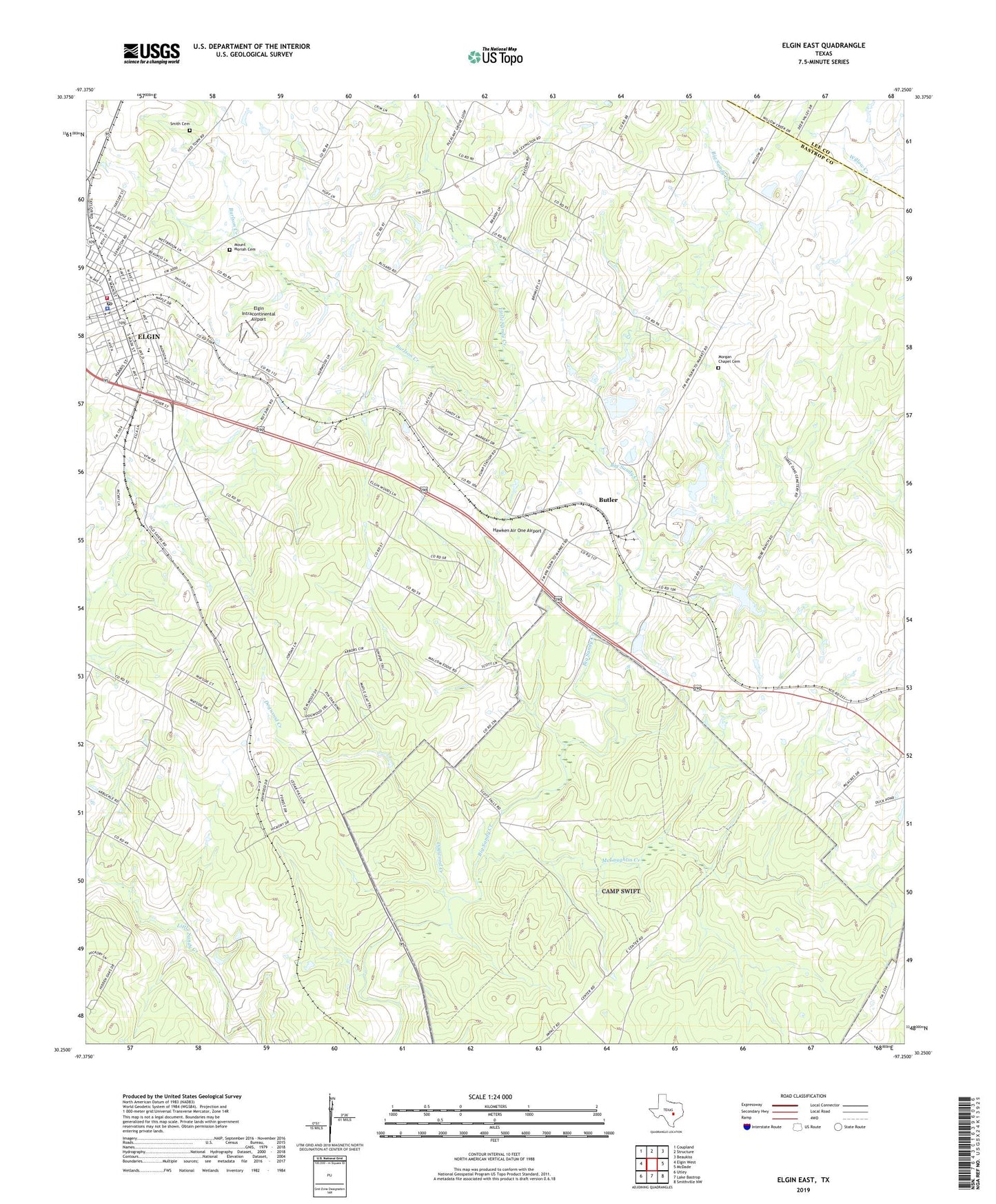
2022 topographic map quadrangle Elgin East in the state of Texas. Scale: 1:24000. Based on the newly updated USGS 7.5' US Topo map series, this map is in the following counties: Bastrop, Lee. The map contains contour data, water features, and other items you are used to seeing on USGS maps, but also has updated roads and other features. This is the next generation of topographic maps. Printed on high-quality waterproof paper with UV fade-resistant inks.
Quads adjacent to this one:
West: Elgin West
Northwest: Coupland
North: Structure
Northeast: Beaukiss
East: McDade
Southeast: Smithville NW
South: Lake Bastrop
Southwest: Utley
This map covers the same area as the classic USGS quad with code o30097c3.
Contains the following named places: Booker T Washington Elementary School, Burlson Creek, Butler, Dogwood Creek, Elgin, Elgin City Hall, Elgin Commercial Historic District, Elgin Division, Elgin Intracontinental Airport, Elgin Police Department, Elgin Post Office, Elgin Volunteer Fire Department, First Baptist Church, First Presbyterian Church, Garwood Ranch, Hawken Air One Airport, KELG-AM (Elgin), KKLB-FM (Elgin), Little Sandy Creek, McLaughlin Creek, MetroCare Services Elgin Station, Morgan Chapel Cemetery, Mount Moriah Baptist Church, Mount Moriah Cemetery, Mount Pleasant School, Pelee School, Primera Iglesia Bautista Church, Ramsey School, Smith Cemetery, Smith Lake, Smith Lake Dam, Winns Memorial Baptist Church, ZIP Code: 78621