MyTopo
Tarkington Prairie Texas US Topo Map
Couldn't load pickup availability
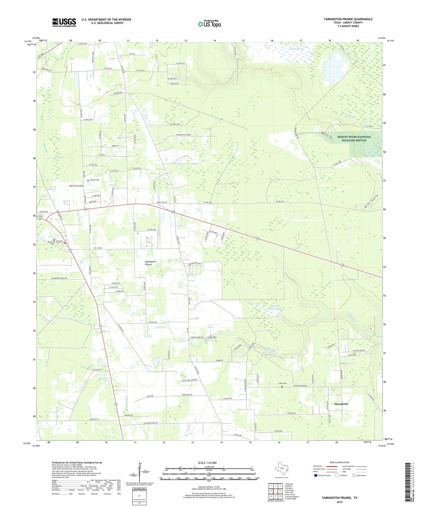
2019 topographic map quadrangle Tarkington Prairie in the state of Texas. Scale: 1:24000. Based on the newly updated USGS 7.5' US Topo map series, this map is in the following counties: Liberty. The map contains contour data, water features, and other items you are used to seeing on USGS maps, but also has updated roads and other features. This is the next generation of topographic maps. Printed on high-quality waterproof paper with UV fade-resistant inks.
Quads adjacent to this one:
West: Cleveland
Northwest: Westcott
North: Rayburn
Northeast: Romayor
East: Davis Hill
Southeast: Capers Ridge
South: Simmons Bottom
Southwest: Plum Grove
Contains the following named places: Boothe Cemetery, Cleveland Division, Faith Tabernacle, Hi-Way Tabernacle, Liberty County Constable's Office Precinct 5, Lumm, Lums Cemetery, Macedonia, McGinnis Cemetery, Oak Shade Church, Oak Shade Fire Tower, Oakdale, Prairie Missionary Church, Rural Shade Church, Silver Bit Lake, Silver Bit Lake Dam, Tarkington Prairie, Tarkington Prairie School, Tarkington Volunteer Fire Department, Thickets Creek, ZIP Code: 77327