MyTopo
Tenaha East Texas US Topo Map
Couldn't load pickup availability
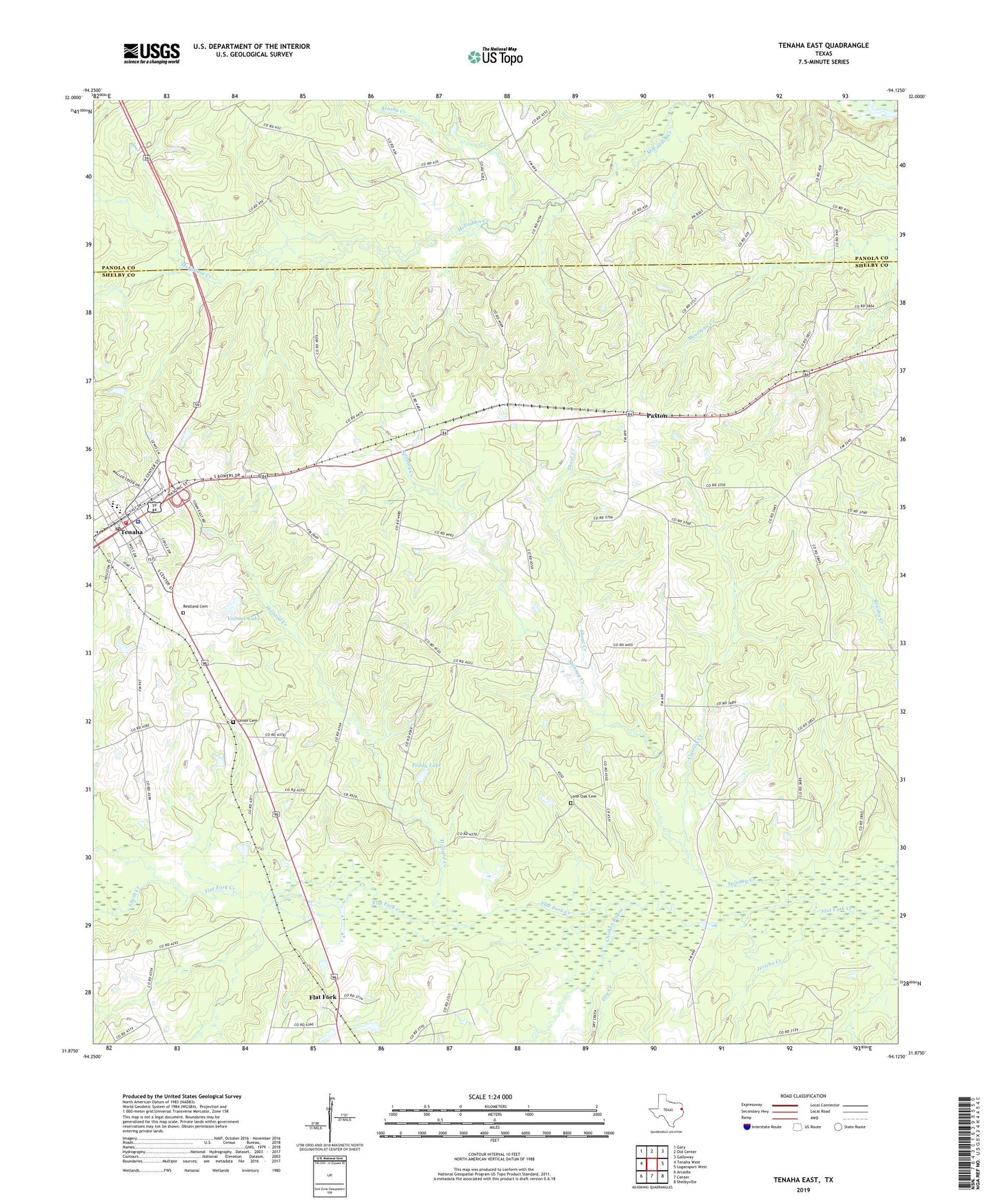
2019 topographic map quadrangle Tenaha East in the state of Texas. Scale: 1:24000. Based on the newly updated USGS 7.5' US Topo map series, this map is in the following counties: Shelby, Panola. The map contains contour data, water features, and other items you are used to seeing on USGS maps, but also has updated roads and other features. This is the next generation of topographic maps. Printed on high-quality waterproof paper with UV fade-resistant inks.
Quads adjacent to this one:
West: Tenaha West
Northwest: Gary
North: Old Center
Northeast: Galloway
East: Logansport West
Southeast: Shelbyville
South: Center
Southwest: Arcadia
Contains the following named places: Brushy Creek, Chicken Bayou, Cypress Creek, Dry Creek, Flat Fork, Hilliard Creek, Jericho Creek, Lone Oak Cemetery, Old Home Church, Paxton, Peddy Lake, Peddy Lake Dam, Pleasant Hill Church, Ramah Church, Restland Cemetery, Shoat Creek, Smith Creek, Spinney Creek, Tenaha, Tenaha City Marshal, Tenaha Municipal Building, Tenaha Police Department, Tenaha Post Office, Tenaha Volunteer Fire Department, Town of Tenaha, Truitt Chapel, Union Cemetery, Valmac Lake, Valmac Lake Dam, Willow Grove Church, ZIP Code: 75974