MyTopo
Gary Texas US Topo Map
Couldn't load pickup availability
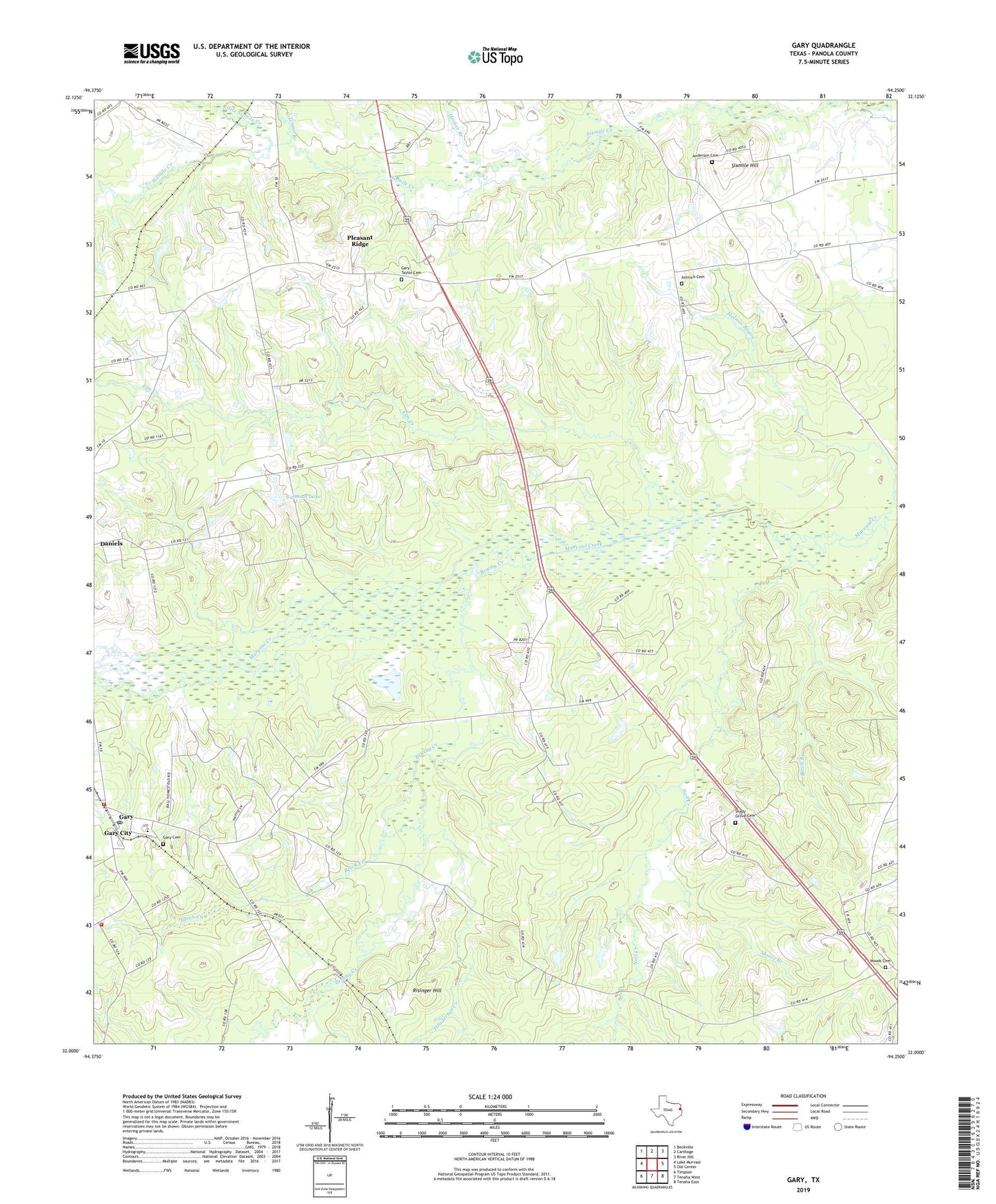
2022 topographic map quadrangle Gary in the state of Texas. Scale: 1:24000. Based on the newly updated USGS 7.5' US Topo map series, this map is in the following counties: Panola. The map contains contour data, water features, and other items you are used to seeing on USGS maps, but also has updated roads and other features. This is the next generation of topographic maps. Printed on high-quality waterproof paper with UV fade-resistant inks.
Quads adjacent to this one:
West: Lake Murvaul
Northwest: Beckville
North: Carthage
Northeast: River Hill
East: Old Center
Southeast: Tenaha East
South: Tenaha West
Southwest: Timpson
This map covers the same area as the classic USGS quad with code o32094a3.
Contains the following named places: Anderson Cemetery, Antioch, Antioch Cemetery, Antioch Church, Beech Branch, Beech Creek, Brushy Creek, Calhoun Lake, Calhoun Lake Dam, Coleman Branch, Elm Creek, Gary, Gary Cemetery, Gary City Division, Gary Post Office, Gary School, Gary Volunteer Fire Department Station 1, Gary Volunteer Fire Department Station 2, Gary-Taylor Cemetery, Henderson Creek, Holmes Bayou, Hooker Branch, Moore Branch, Mount Calvary Church, Nail Creek, Pleasant Ridge, Risinger Hill, Shady Grove, Shady Grove Cemetery, Shady Grove Church, Sixmile Hill, Southside School, Town of Gary City, Woods Cemetery, Woods Methodist Church, ZIP Code: 75643