MyTopo
Tenaha West Texas US Topo Map
Couldn't load pickup availability
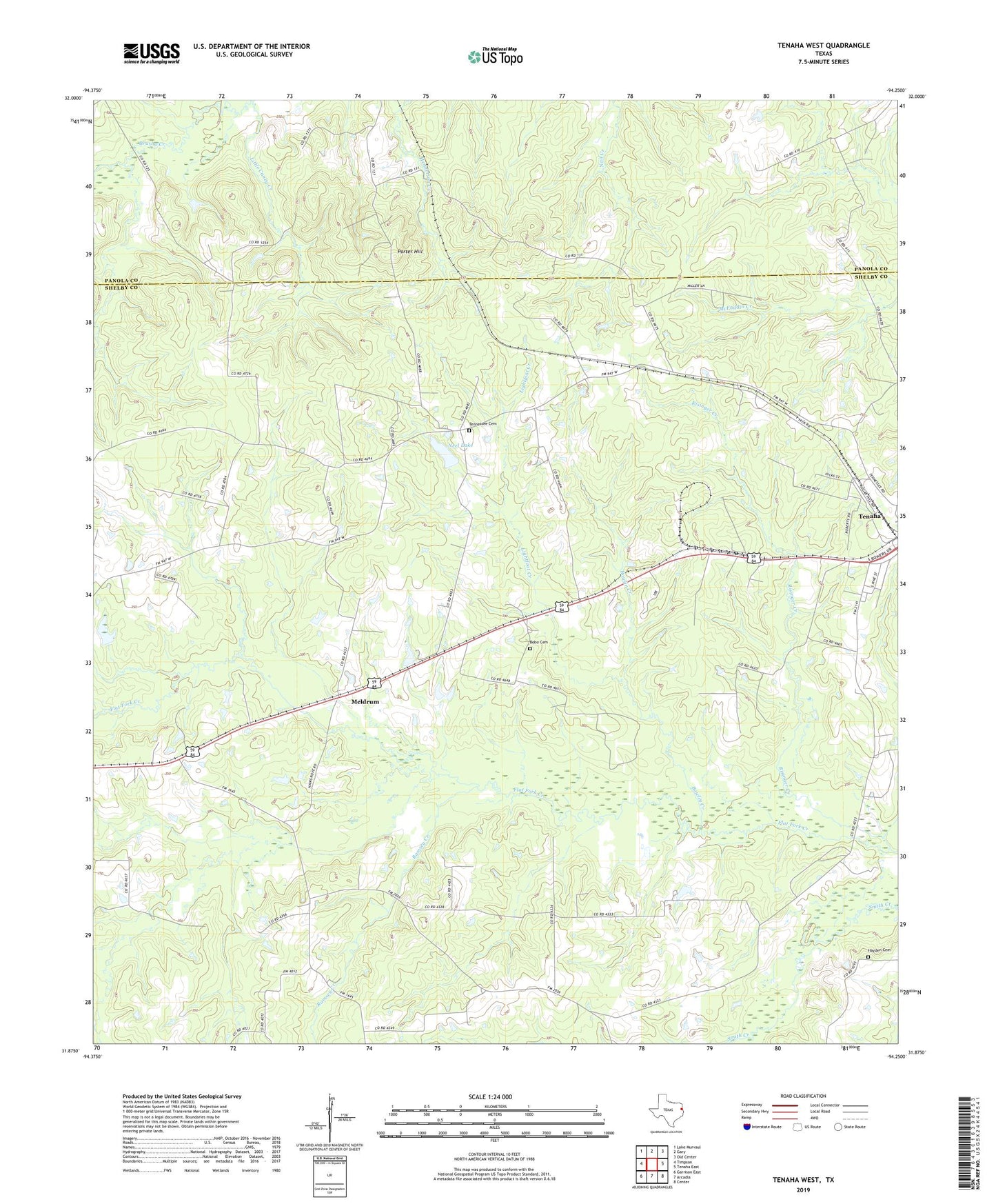
2019 topographic map quadrangle Tenaha West in the state of Texas. Scale: 1:24000. Based on the newly updated USGS 7.5' US Topo map series, this map is in the following counties: Shelby, Panola. The map contains contour data, water features, and other items you are used to seeing on USGS maps, but also has updated roads and other features. This is the next generation of topographic maps. Printed on high-quality waterproof paper with UV fade-resistant inks.
Quads adjacent to this one:
West: Timpson
Northwest: Lake Murvaul
North: Gary
Northeast: Old Center
East: Tenaha East
Southeast: Center
South: Arcadia
Southwest: Garrison East
Contains the following named places: Bobo, Bobo Cemetery, Bobo Church, Bowlin Creek, Buena Vista Church, Enterprise Church, Hayden Cemetery, Lightfoot Creek, Little Caney Creek, Meldrum, Neel Lake, Neel Lake Dam, Porter Hill, Prospect Church, Ramsey Creek, Risinger Creek, Saxet, Smith Creek, Tennessee, Tennessee Cemetery