MyTopo
Texline North Texas US Topo Map
Couldn't load pickup availability
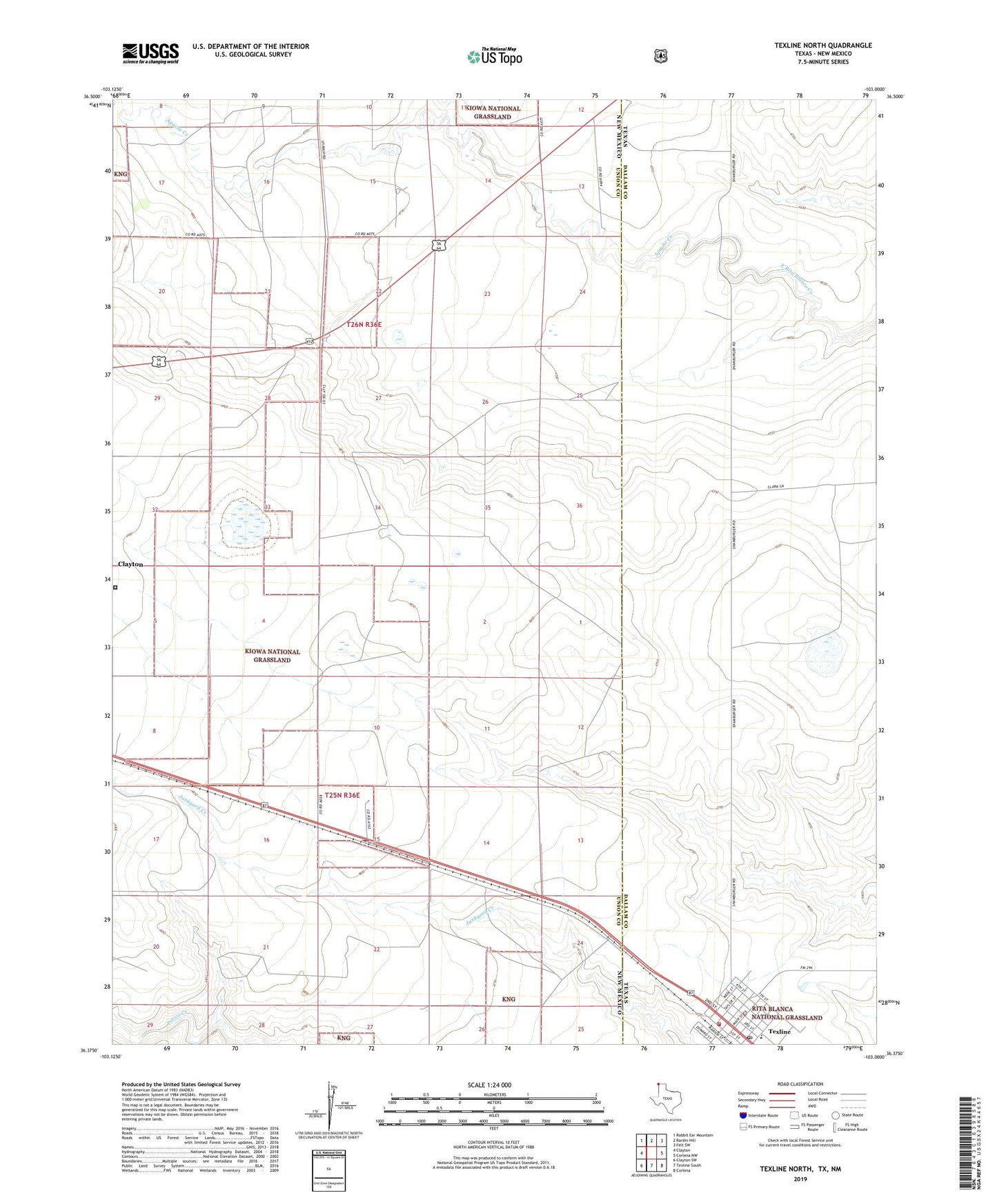
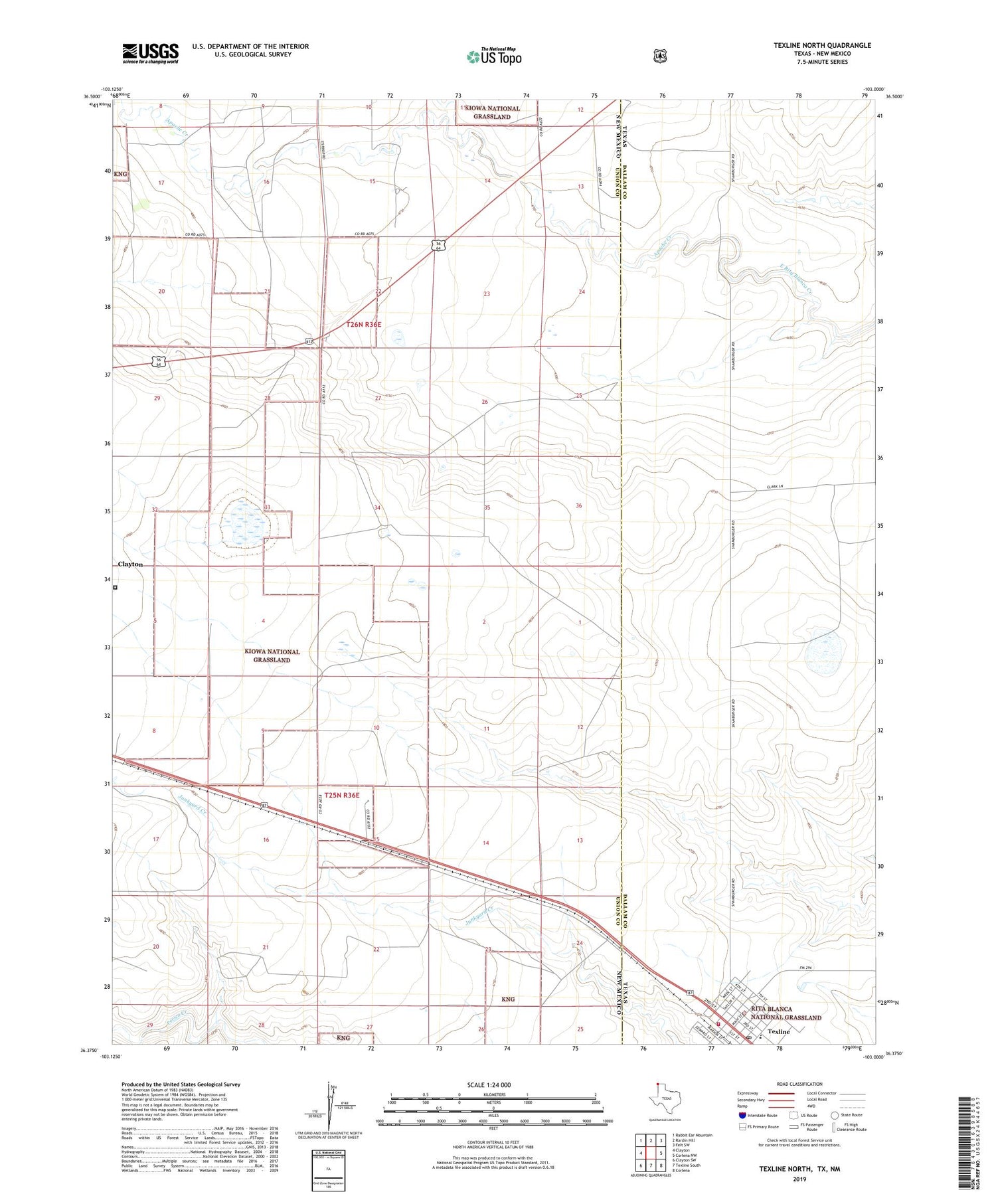
2019 topographic map quadrangle Texline North in the states of New Mexico, Texas. Scale: 1:24000. Based on the newly updated USGS 7.5' US Topo map series, this map is in the following counties: Dallam, Union. The map contains contour data, water features, and other items you are used to seeing on USGS maps, but also has updated roads and other features. This is the next generation of topographic maps. Printed on high-quality waterproof paper with UV fade-resistant inks.
Quads adjacent to this one:
West: Clayton
Northwest: Rabbit Ear Mountain
North: Rardin Hill
Northeast: Felt SW
East: Corlena NW
Southeast: Corlena
Southwest: Clayton SW
Contains the following named places: Apache Creek, Clayton Livestock Research Area, Goodin Draw, Northeast New Mexico Detention Facility, Rita Blanca Ranger Station, Rita Blanca Work Center, Texline, Texline Post Office, Texline School, Texline Volunteer Fire and Rescue Department, Town of Texline