MyTopo
Trinity East Texas US Topo Map
Couldn't load pickup availability
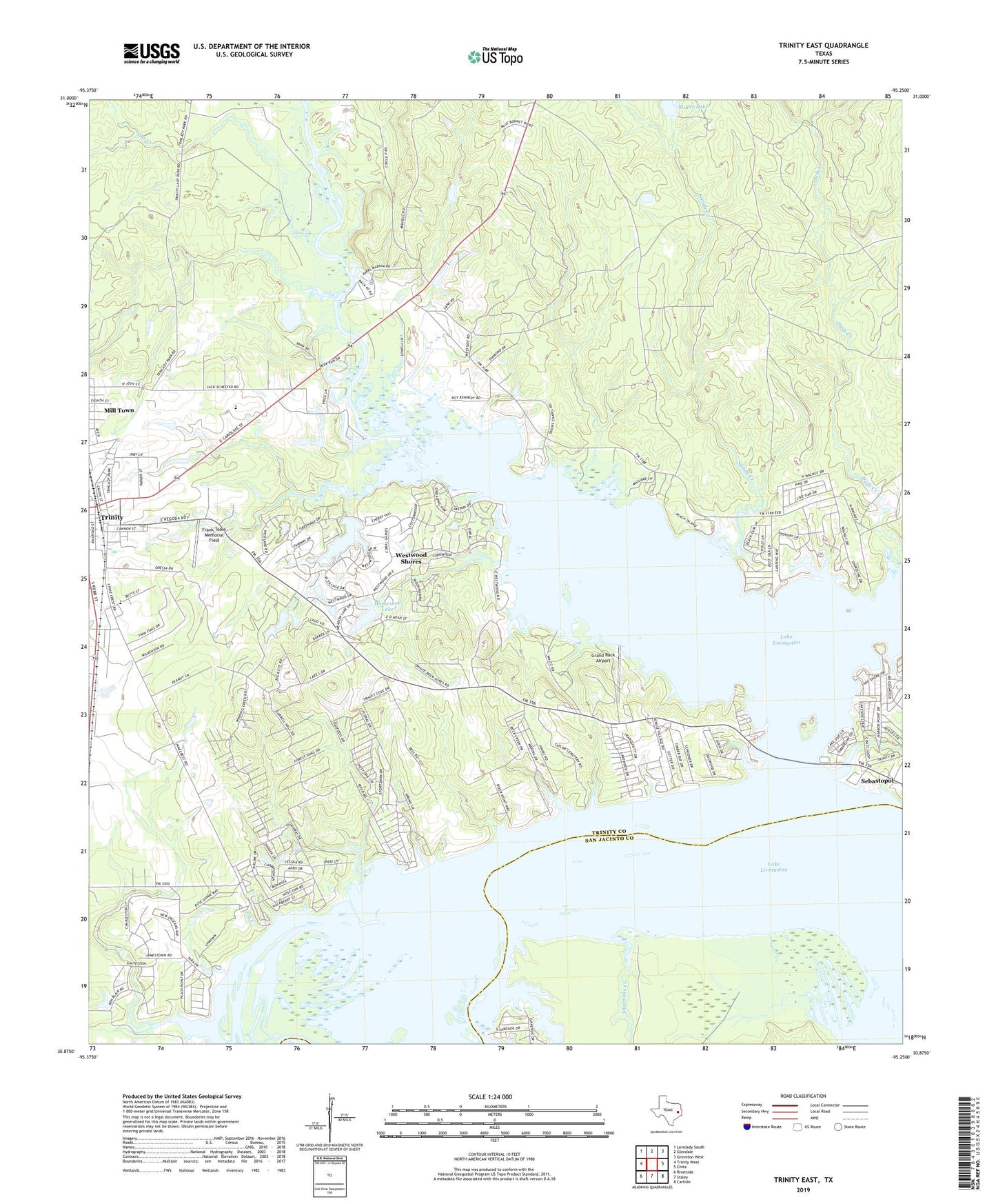
2019 topographic map quadrangle Trinity East in the state of Texas. Scale: 1:24000. Based on the newly updated USGS 7.5' US Topo map series, this map is in the following counties: Trinity, San Jacinto, Walker. The map contains contour data, water features, and other items you are used to seeing on USGS maps, but also has updated roads and other features. This is the next generation of topographic maps. Printed on high-quality waterproof paper with UV fade-resistant inks.
Quads adjacent to this one:
West: Trinity West
Northwest: Lovelady South
North: Glendale
Northeast: Groveton West
East: Chita
Southeast: Carlisle
South: Staley
Southwest: Riverside
Contains the following named places: Caney Creek, City of Trinity, Dads Creek, Frank Toole Memorial Field, Grand Rock Airport, Horseshoe Lake, Huntly Millar Lake Dam, Mill Town, Millar Lake, Salt Creek, Sandy Creek, Shoemake Creek, Trinity Division, Westwood Lake, Westwood Shores Census Designated Place, Westwood Shores Lake Number 2 Dam, Westwood Shores Lake Number 3 Dam, White Rock Creek, ZIP Code: 75862