MyTopo
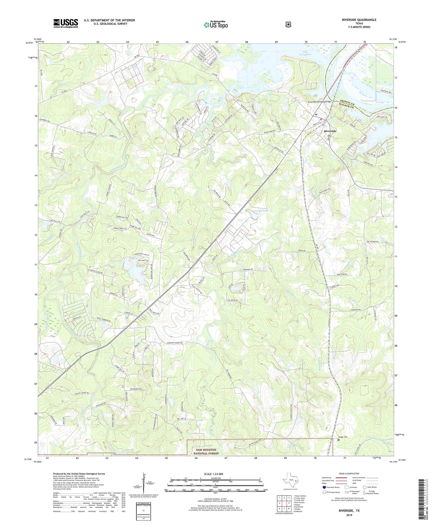
Riverside Texas US Topo Map
Couldn't load pickup availability
Also explore the Riverside Forest Service Topo of this same quad for updated USFS data
2022 topographic map quadrangle Riverside in the state of Texas. Scale: 1:24000. Based on the newly updated USGS 7.5' US Topo map series, this map is in the following counties: Walker, Trinity. The map contains contour data, water features, and other items you are used to seeing on USGS maps, but also has updated roads and other features. This is the next generation of topographic maps. Printed on high-quality waterproof paper with UV fade-resistant inks.
Quads adjacent to this one:
West: Pine Prairie
Northwest: Wyser Bottom
North: Trinity West
Northeast: Trinity East
East: Staley
Southeast: Oakhurst
South: Phelps
Southwest: Huntsville
This map covers the same area as the classic USGS quad with code o30095g4.
Contains the following named places: Arizona, Broyles Church, Camp Alice, Campus Lake, Caney Creek, Carolina, Cedar Creek, City of Riverside, Dodge Cemetery, Dodge Junior High School, Harmon Creek, Holmes Chapel, Horseshoe Lake Number 1 Dam, Horseshoe Lake Number 2, Horseshoe Lake Number 2 Dam, Lake Forest, Lake Forest Dam, Mud Lake, Parker Creek, Pilgrim Ridge Church, Red Oak Creek, Riverside, Riverside Division, Riverside Post Office, Riverside Swinging Bridge, Riverside Volunteer Fire Department, Rocky Creek, Saint Marys Church, Saint Olive Church, Sam Houston State Teachers College, Spring Creek, Styles Lake 1, Tan Yard Branch, Thessalonto Church, Turkey Creek, Walker County Constable's Office Precinct 3, ZIP Code: 77367