MyTopo
Turkey Knob Texas US Topo Map
Couldn't load pickup availability
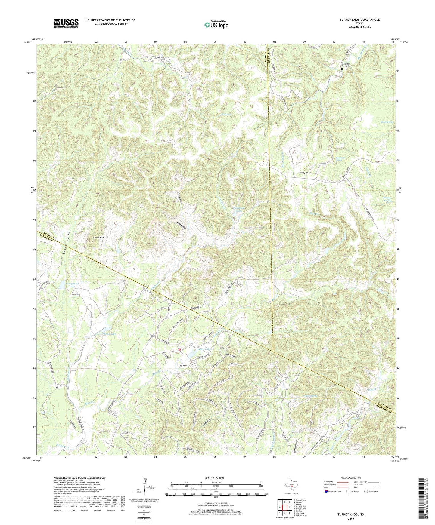
2019 topographic map quadrangle Turkey Knob in the state of Texas. Scale: 1:24000. Based on the newly updated USGS 7.5' US Topo map series, this map is in the following counties: Bandera, Kerr, Kendall. The map contains contour data, water features, and other items you are used to seeing on USGS maps, but also has updated roads and other features. This is the next generation of topographic maps. Printed on high-quality waterproof paper with UV fade-resistant inks.
Quads adjacent to this one:
West: Bandera Pass
Northwest: Center Point
North: Comfort
Northeast: Waring
East: Ranger Creek
Southeast: Jack Mountain
South: Pipe Creek
Southwest: Bandera
Contains the following named places: Bald Hollow, Bear Creek, Bear Springs Blossom Nature Preserve, Berry Lake, Berry Lake Dam, Brown Spring, Castle Lake, Castle Lake Dam, Castle Lake Ranch Volunteer Fire Department, Champee Spring, Cherry Hollow, Christophs Lake, Cloud Hollow, Cloud Mountain, Langridge Family Cemetery, Polly Cemetery, Privilege School, Rodriquez Church, Sycamore Spring, Turkey Knob, Wagner Spring, Youngblood Lake, Youngblood Lake Dam