MyTopo
Utley Texas US Topo Map
Couldn't load pickup availability
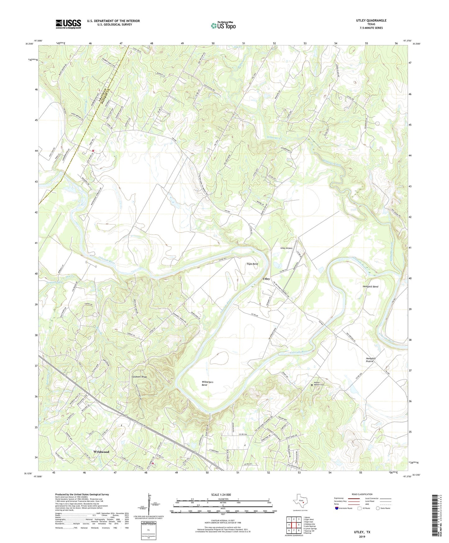
2019 topographic map quadrangle Utley in the state of Texas. Scale: 1:24000. Based on the newly updated USGS 7.5' US Topo map series, this map is in the following counties: Bastrop, Travis. The map contains contour data, water features, and other items you are used to seeing on USGS maps, but also has updated roads and other features. This is the next generation of topographic maps. Printed on high-quality waterproof paper with UV fade-resistant inks.
Quads adjacent to this one:
West: Webberville
Northwest: Manor
North: Elgin West
Northeast: Elgin East
East: Lake Bastrop
Southeast: Bastrop
South: Bastrop SW
Southwest: Lytton Springs
Contains the following named places: Bluebonnet Volunteer Fire Department 969 Station, Bluebonnet Volunteer Fire Department Still Forest Station, Caldwell Knob, Coleman Branch, Cottonwood Creek, Dry Creek, Hemphill Bend, Hemphill Prairie, Moss Branch, Northern Loop Trail, Pope Bend, Red Gully Creek, Southern Loop Trail, Union Hill School, Utley, Utley Airport, Village of Webberville, Walker-Watson Cemetery, Wilbarger Creek, Wilbargers Bend, Wildflower Trail, Wyldwood, Wyldwood Census Designated Place