MyTopo
Manor Texas US Topo Map
Couldn't load pickup availability
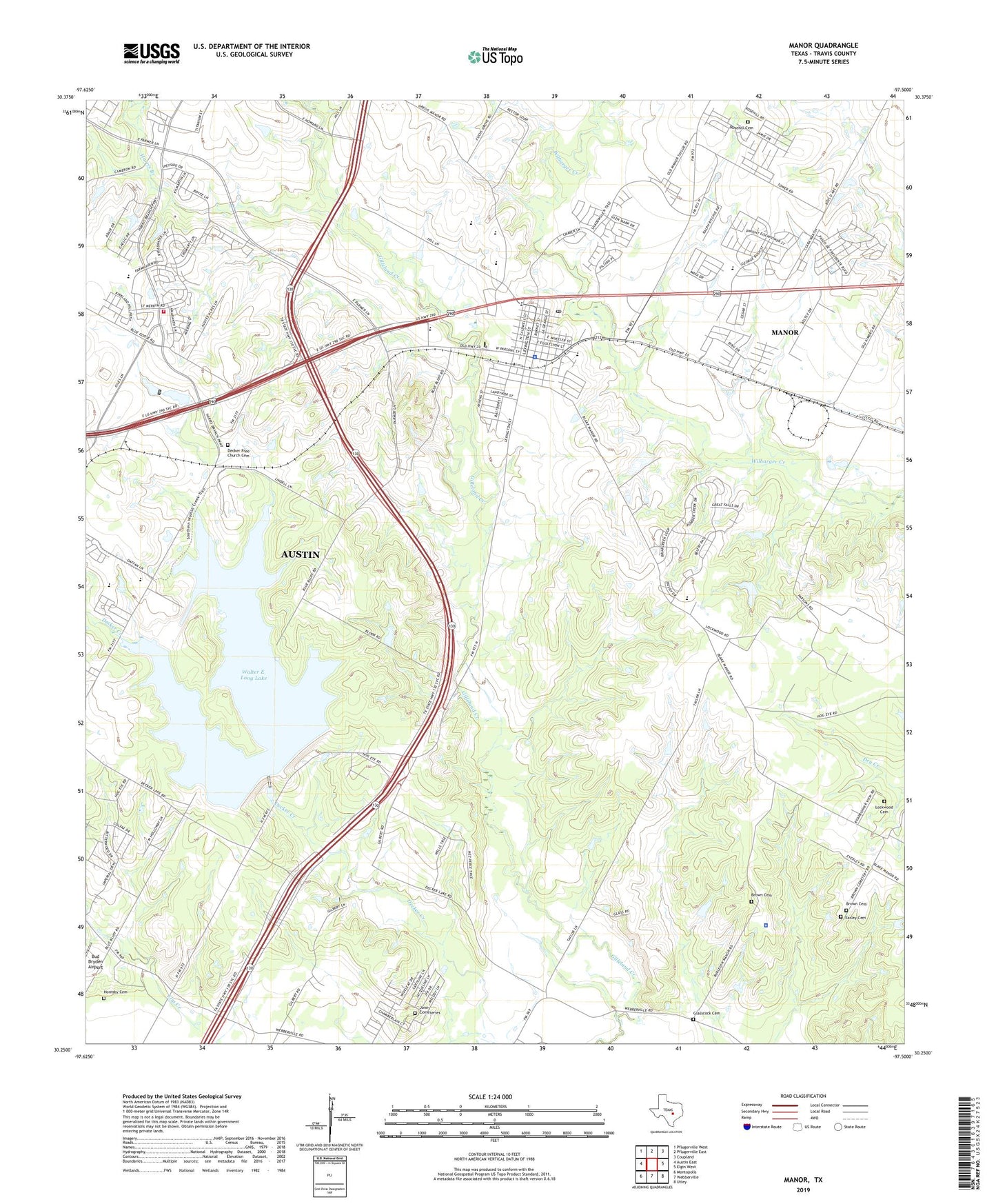
2022 topographic map quadrangle Manor in the state of Texas. Scale: 1:24000. Based on the newly updated USGS 7.5' US Topo map series, this map is in the following counties: Travis. The map contains contour data, water features, and other items you are used to seeing on USGS maps, but also has updated roads and other features. This is the next generation of topographic maps. Printed on high-quality waterproof paper with UV fade-resistant inks.
Quads adjacent to this one:
West: Austin East
Northwest: Pflugerville West
North: Pflugerville East
Northeast: Coupland
East: Elgin West
Southeast: Utley
South: Webberville
Southwest: Montopolis
This map covers the same area as the classic USGS quad with code o30097c5.
Contains the following named places: Austin / Travis County Emergency Medical Service - Medic 35, Austin Fire Department Station 41, Bluebonnet Trail Elementary School, Brown Cemetery, Bud Dryden Airport, City of Manor, Decker, Decker Creek Dam, Decker Creek Power Plant, Decker Free Church Cemetery, Decker United Methodist Church, Easley Cemetery, East Metropolitan Park, Glasscock Cemetery, Greater Swenson Grove Missionary Baptist Church, Harris Branch, Harris Branch Wastewater Treatment Plant, Hornsby Cemetery, Jones Cemeteries, KELG-AM (Manor), KIXL-AM (Del Valle), Lockwood Cemetery, Manor, Manor City Hall, Manor High School, Manor Police Department, Manor Post Office, New Katy, Oak Crest Manor Nursing Home, Park Spring, Park Springs Church, Rosehill Cemetery, Travis County Emergency Services District 12 Station 1, Travis County Sheriff's Office East Command, Walter E Long Municipal Park, Walter E. Long Lake, Wilbarger Creek Wastewater Treatment Plant, ZIP Codes: 78653, 78724