MyTopo
Viboras Texas US Topo Map
Couldn't load pickup availability
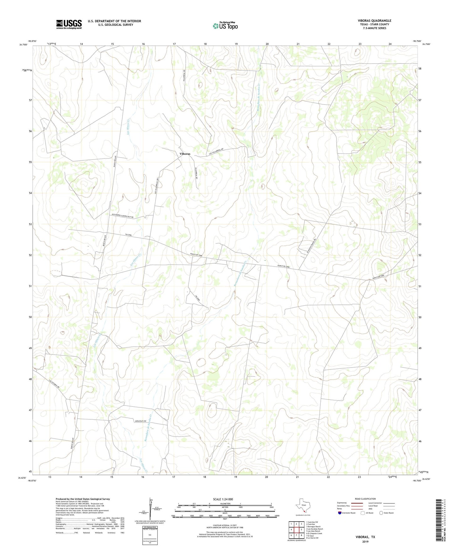
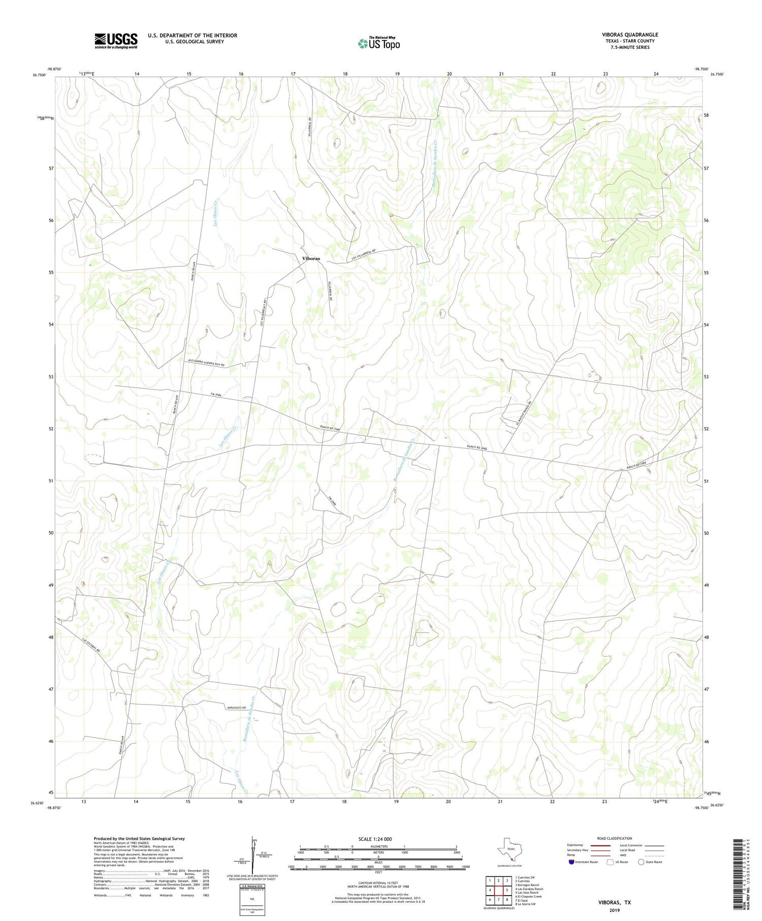
2019 topographic map quadrangle Viboras in the state of Texas. Scale: 1:24000. Based on the newly updated USGS 7.5' US Topo map series, this map is in the following counties: Starr. The map contains contour data, water features, and other items you are used to seeing on USGS maps, but also has updated roads and other features. This is the next generation of topographic maps. Printed on high-quality waterproof paper with UV fade-resistant inks.
Quads adjacent to this one:
West: Las Escobas Ranch
Northwest: Cuevitas SW
North: Cuevitas
Northeast: Borregos Ranch
East: Las Islas Ranch
Southeast: La Gloria SW
South: El Sauz
Southwest: El Chapote Creek
Contains the following named places: Agua Leguas Windmill, Alto Bonito Windmill, Alto Windmill, Canada Honda, Cirildo Tank, Garbancillo Tank, Garza Windmill, Leoncitos Windmill, Los Charcos Tank, Monterrey Tank, Realito Windmill, Remadura de Sandia Creek, San Carlos, Tecomate Windmill, Tia Ramona Windmill, Tigre Windmill, Venadito Windmill, Viboras