MyTopo
Borregos Ranch Texas US Topo Map
Couldn't load pickup availability
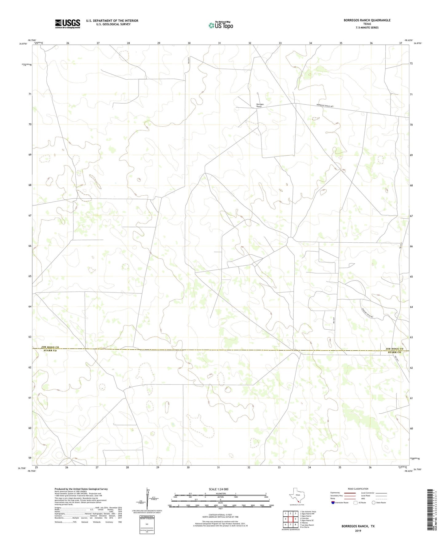
2022 topographic map quadrangle Borregos Ranch in the state of Texas. Scale: 1:24000. Based on the newly updated USGS 7.5' US Topo map series, this map is in the following counties: Jim Hogg, Starr. The map contains contour data, water features, and other items you are used to seeing on USGS maps, but also has updated roads and other features. This is the next generation of topographic maps. Printed on high-quality waterproof paper with UV fade-resistant inks.
Quads adjacent to this one:
West: Cuevitas
Northwest: San Antonio Viejo
North: Agua Nueva NW
Northeast: Agua Nueva
East: Agua Nueva SE
Southeast: La Gloria
South: Las Islas Ranch
Southwest: Viboras
This map covers the same area as the classic USGS quad with code o26098g6.
Contains the following named places: Aurora Ranch Cemetery, Aurora Ranch Cemetery 2, Borregos Ranch, Buena Vista Windmill, Buenos Aires Ranch, Calavazas Windmill, Camote Windmill, Charco Nuevo Windmill, Fermin Olivarez Junior Cemetery, Granjenitos Ranch, Huisache Windmill, Juanitas Ranch, Lobitos Windmill, Los Corrales Windmill, Mescalito Windmill, Mirasoles Windmill, Moriea Windmill, Realero Windmill, Sacatones Windmill, San Carlos Windmill, San Jose Tank, San Jose Windmill, San Juan Windmills, Santa Barbara Windmill, Sordo Windmill, Sufrimiento Windmill, Tiradores Windmill, Tres Esquinas Windmill, Viente dos Windmill