MyTopo
Las Islas Ranch Texas US Topo Map
Couldn't load pickup availability
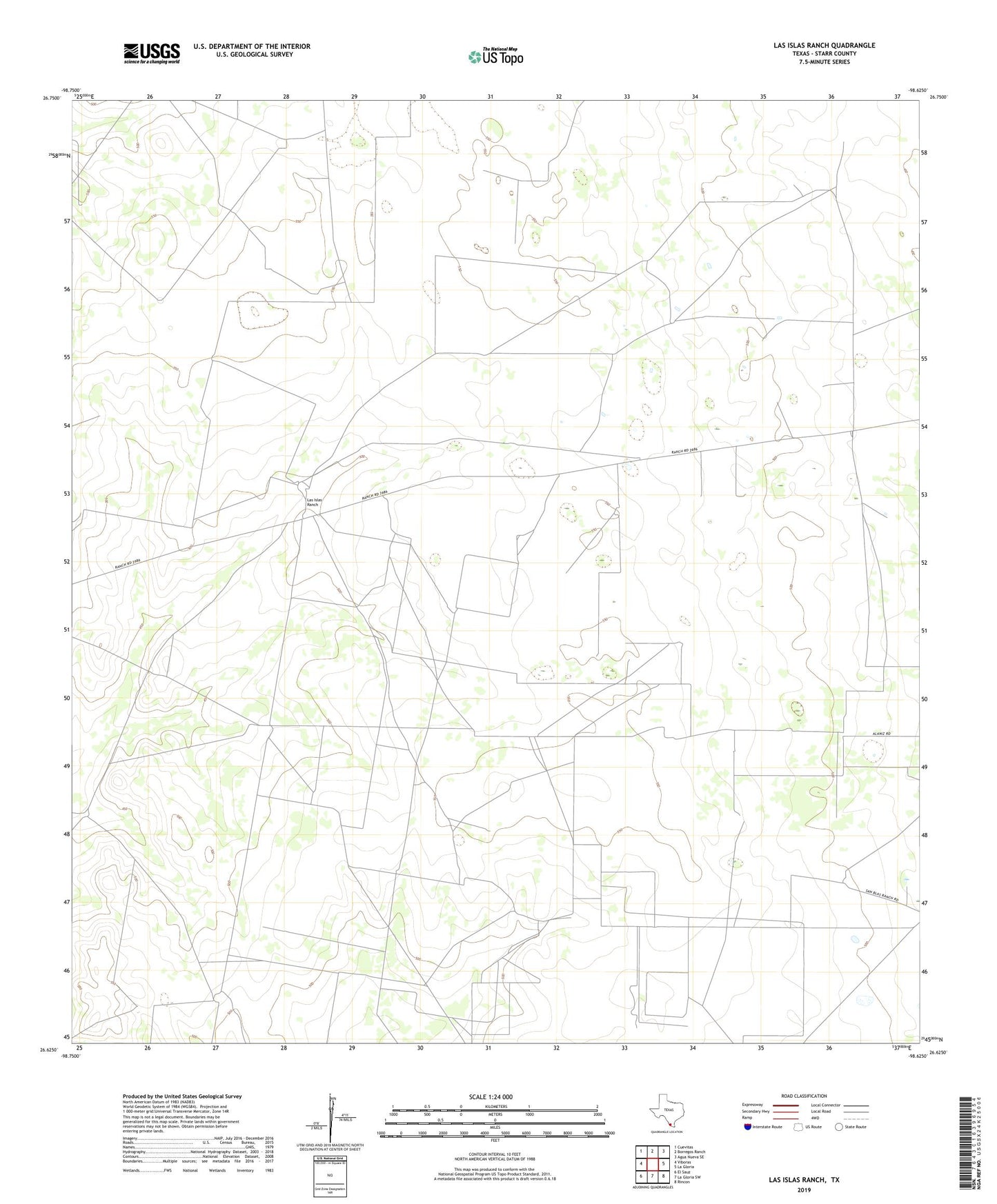
2022 topographic map quadrangle Las Islas Ranch in the state of Texas. Scale: 1:24000. Based on the newly updated USGS 7.5' US Topo map series, this map is in the following counties: Starr. The map contains contour data, water features, and other items you are used to seeing on USGS maps, but also has updated roads and other features. This is the next generation of topographic maps. Printed on high-quality waterproof paper with UV fade-resistant inks.
Quads adjacent to this one:
West: Viboras
Northwest: Cuevitas
North: Borregos Ranch
Northeast: Agua Nueva SE
East: La Gloria
Southeast: Rincon
South: La Gloria SW
Southwest: El Sauz
This map covers the same area as the classic USGS quad with code o26098f6.
Contains the following named places: Borrego Windmill, Brazil Windmill, Cinca de Mayo Windmill, El Brazil Windmill, El Cerrito Windmill, El Golto Windmill, La Pita Well, La Purisma Windmill, Las Comas Windmill, Las Islas Ranch, Las Minas Windmill, San Antonio Windmill, San Felipe Windmill, San Juan Windmill, San Luis Windmill, Tiradores Windmill