
MyTopo
Wallis Texas US Topo Map
Couldn't load pickup availability
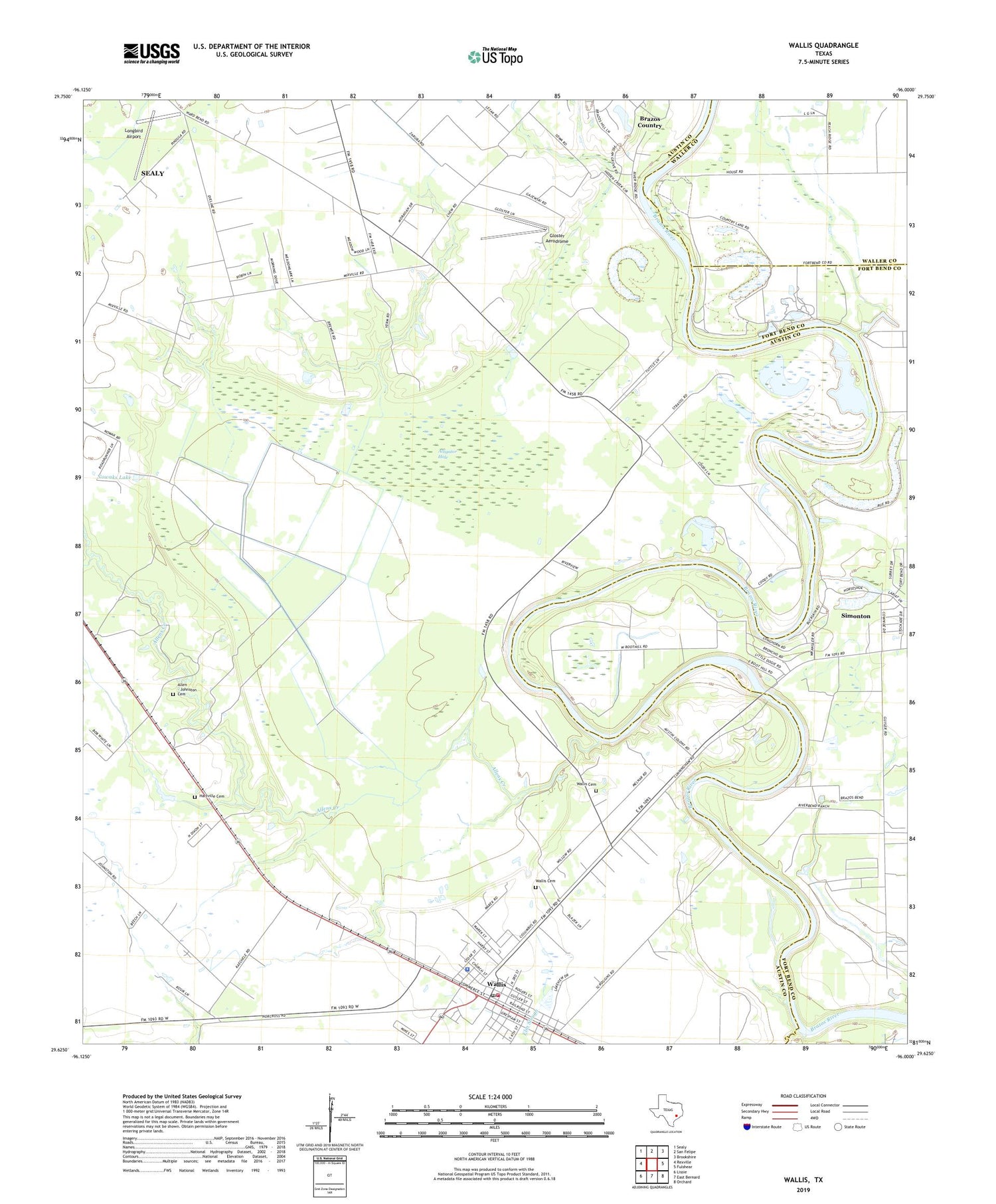
2019 topographic map quadrangle Wallis in the state of Texas. Scale: 1:24000. Based on the newly updated USGS 7.5' US Topo map series, this map is in the following counties: Austin, Fort Bend, Waller. The map contains contour data, water features, and other items you are used to seeing on USGS maps, but also has updated roads and other features. This is the next generation of topographic maps. Printed on high-quality waterproof paper with UV fade-resistant inks.
Quads adjacent to this one:
West: Rexville
Northwest: Sealy
North: San Felipe
Northeast: Brookshire
East: Fulshear
Southeast: Orchard
South: East Bernard
Southwest: Lissie
Contains the following named places: Allens Cemetery, Allens Creek, Alligator Hole, Cannons Lake, Church of the Guardian Angel, City of South Frydek, City of Wallis, El Pleasant, Evans Chapel, Gloster Aerodrome, Hartville Cemetery, Little Bethlehem Church, Longbird Airport, Mount Olive Church, Mount Zion Church, Nowaks Lake, Parker Chapel, South Frydek, Valley Lodge Clubhouse, Wallis, Wallis Cemetery, Wallis City Hall, Wallis Division, Wallis Police Department, Wallis Post Office, Wallis Volunteer Fire Department, Wards Lake, West Mount Olive Church, Williams School, ZIP Code: 77485


