MyTopo
San Felipe Texas US Topo Map
Couldn't load pickup availability
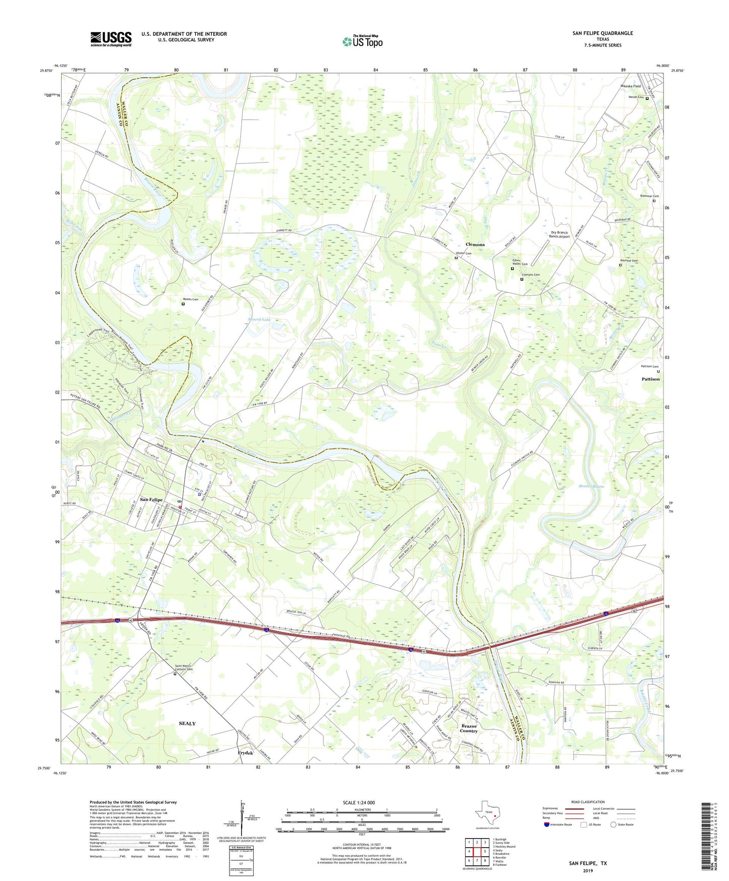
2022 topographic map quadrangle San Felipe in the state of Texas. Scale: 1:24000. Based on the newly updated USGS 7.5' US Topo map series, this map is in the following counties: Waller, Austin. The map contains contour data, water features, and other items you are used to seeing on USGS maps, but also has updated roads and other features. This is the next generation of topographic maps. Printed on high-quality waterproof paper with UV fade-resistant inks.
Quads adjacent to this one:
West: Sealy
Northwest: Burleigh
North: Sunny Side
Northeast: Hockley Mound
East: Brookshire
Southeast: Fulshear
South: Wallis
Southwest: Rexville
This map covers the same area as the classic USGS quad with code o29096g1.
Contains the following named places: Bessies Bayou, Bozeman Cemetery, Brazos Country, Bullinger Creek, City of Brazos Country, City Park, Clemons, Clemons Cemetery, Clemons High School, Diamond E Ranch Heliport, Downeys Chapel, Dry Branch, Dry Branch Ranch Airport, Edwin Waller Cemetery, Frydek, Frydek Catholic Cemetery, Frydek School, Garret Lake, Irons Creek, Kholor Cemetery, Kountze Cemetery, Mikeska Field, Mill Creek, Mound Lake, Pattison Cemetery, Prairie View Church, Rosses Cemetery, Sampson Church, San Felipe, San Felipe Frydek Volunteer Fire Department, San Felipe Oil Field, San Felipe Police Department, San Felipe Post Office, San Felipe Siding, Stephen F Austin State Historical Park Trail, Stephen F Austin State Park, Town of San Felipe, Wades Chapel, Wendt Cemetery, Wesley Chapel, Williams Chapel, ZIP Codes: 77466, 77473