MyTopo
Fulshear Texas US Topo Map
Couldn't load pickup availability
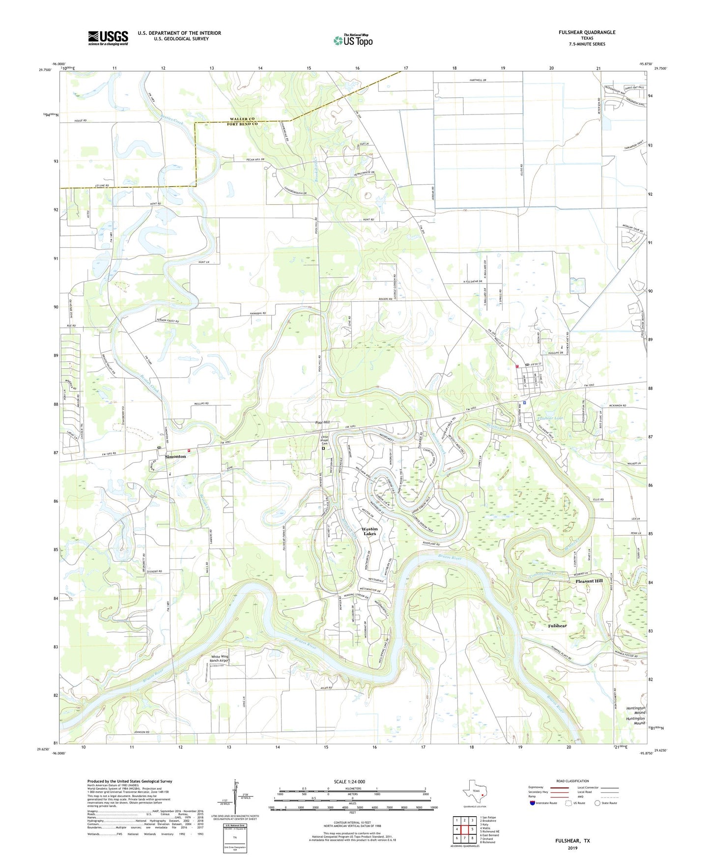
2022 topographic map quadrangle Fulshear in the state of Texas. Scale: 1:24000. Based on the newly updated USGS 7.5' US Topo map series, this map is in the following counties: Fort Bend, Waller. The map contains contour data, water features, and other items you are used to seeing on USGS maps, but also has updated roads and other features. This is the next generation of topographic maps. Printed on high-quality waterproof paper with UV fade-resistant inks.
Quads adjacent to this one:
West: Wallis
Northwest: San Felipe
North: Brookshire
Northeast: Katy
East: Richmond NE
Southeast: Richmond
South: Orchard
Southwest: East Bernard
This map covers the same area as the classic USGS quad with code o29095f8.
Contains the following named places: Baytown Medical Center Heliport, Bessies Creek, Bob Lutts Fulshear/Simonton Branch Library, Brookshire Creek, City of Simonton, City of Weston Lakes, Cottonwood Creek, Fendley Airport, Fulshear, Fulshear City Hall, Fulshear Lake, Fulshear Police Department, Fulshear Post Office, Fulshear Simonton Fire Department Station 1, Jerusalem Starlight Church, Little Prayer Cemetery, Pittsville, Pleasant Hill, Pleasant Hill Church, Pool Hill, Saint Johns Church, Saint Mathews Church, Saint Pauls Church, Simonton, Simonton Fire Station, Simonton Post Office, Weston Lakes, Weston Lakes Country Club, White Wing Ranch Airport, Zion Chapel, ZIP Codes: 77441, 77476