MyTopo
Sealy Texas US Topo Map
Couldn't load pickup availability
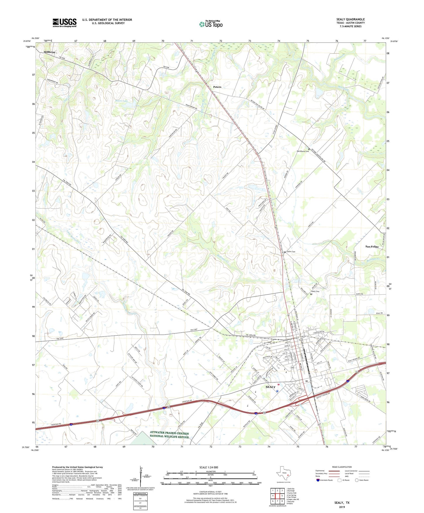
2022 topographic map quadrangle Sealy in the state of Texas. Scale: 1:24000. Based on the newly updated USGS 7.5' US Topo map series, this map is in the following counties: Austin. The map contains contour data, water features, and other items you are used to seeing on USGS maps, but also has updated roads and other features. This is the next generation of topographic maps. Printed on high-quality waterproof paper with UV fade-resistant inks.
Quads adjacent to this one:
West: Cat Spring
Northwest: Bellville
North: Burleigh
Northeast: Sunny Side
East: San Felipe
Southeast: Wallis
South: Rexville
Southwest: Eagle Lake NE
This map covers the same area as the classic USGS quad with code o29096g2.
Contains the following named places: Austin County Constable's Office Precinct 3, City of Sealy, Glenn Cemetery, Macedonia, Macedonia Cemetery, Millheim, Peters, Peters Lake, Peters Lake Dam, Pine Tree Branch, Sealy, Sealy Cemetery, Sealy City Hall, Sealy Division, Sealy Emergency Medical Services, Sealy Fire Department, Sealy High School, Sealy Junior High School, Sealy Police Department, Sealy Post Office, Selman Elementary School, Selman Intermediate School, William Creek, ZIP Code: 77474