MyTopo
Wells Ranch Texas US Topo Map
Couldn't load pickup availability
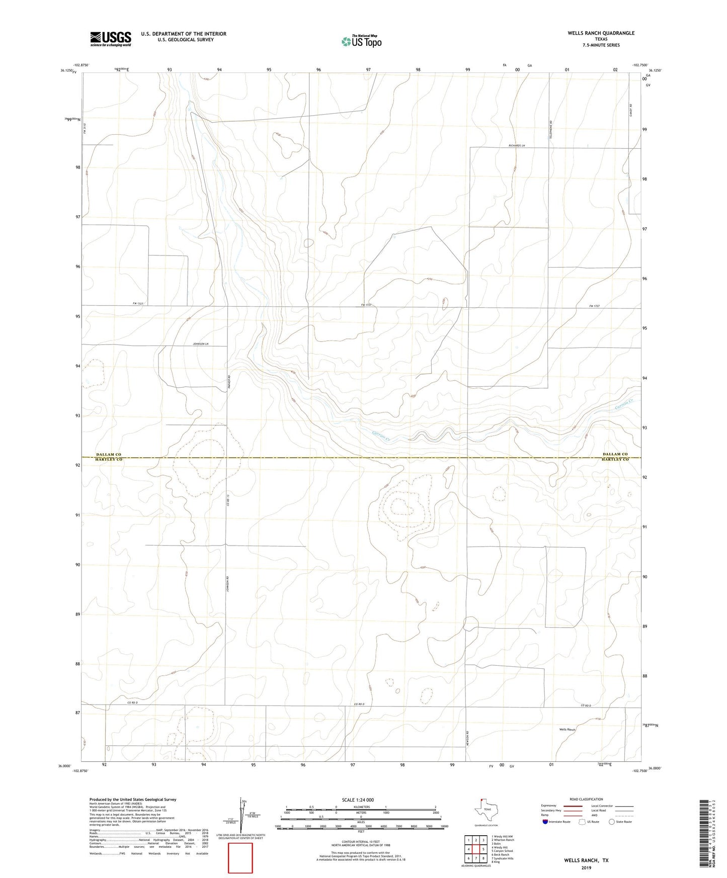
2022 topographic map quadrangle Wells Ranch in the state of Texas. Scale: 1:24000. Based on the newly updated USGS 7.5' US Topo map series, this map is in the following counties: Dallam, Hartley. The map contains contour data, water features, and other items you are used to seeing on USGS maps, but also has updated roads and other features. This is the next generation of topographic maps. Printed on high-quality waterproof paper with UV fade-resistant inks.
Quads adjacent to this one:
West: Windy Hill
Northwest: Windy Hill NW
North: Wharton Ranch
Northeast: Bolin
East: Canyon School
Southeast: King
South: Syndicate Hills
Southwest: Beck Ranch
This map covers the same area as the classic USGS quad with code o36102a7.
Contains the following named places: Bonner Camp Well, Canyon Well, North Bennett Well, Seventy Well, Seventyfive Well, Seventyone Well, Seventyseven Well, Seventytwo Well, Sis Well, Sixtynine Well, Steele Well, Wells Ranch, White Well, Woody Well, XIT Bennett Well