
MyTopo
West Sweden Texas US Topo Map
Couldn't load pickup availability
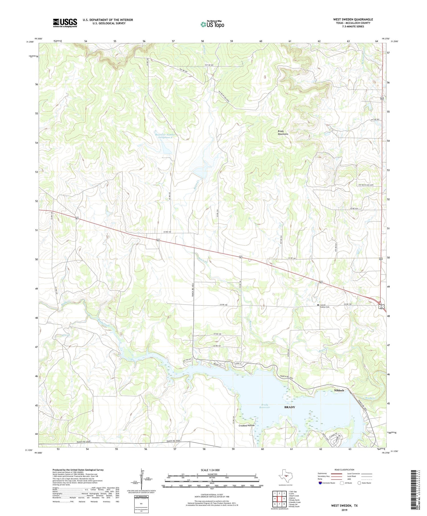
2019 topographic map quadrangle West Sweden in the state of Texas. Scale: 1:24000. Based on the newly updated USGS 7.5' US Topo map series, this map is in the following counties: McCulloch. The map contains contour data, water features, and other items you are used to seeing on USGS maps, but also has updated roads and other features. This is the next generation of topographic maps. Printed on high-quality waterproof paper with UV fade-resistant inks.
Quads adjacent to this one:
West: Melvin
Northwest: Salt Gap
North: Lohn
Northeast: Bluff Creek
East: Brady North
Southeast: Brady South
South: Brady SW
Southwest: Needle Creek
Contains the following named places: Bear Creek, Bowie Creek, Brady Dam, Brady Reservoir, Carroll Colony Cemetery, City of Brady, Cow Creek, Crooked Hollow, Niblock, Reservoir Number Fortythree A, Reservoir Number Fortythree B, Soil Conservation Service Site 43a Dam, Soil Conservation Service Site 43b Dam, West Sweden


