MyTopo
Whitsett Texas US Topo Map
Couldn't load pickup availability
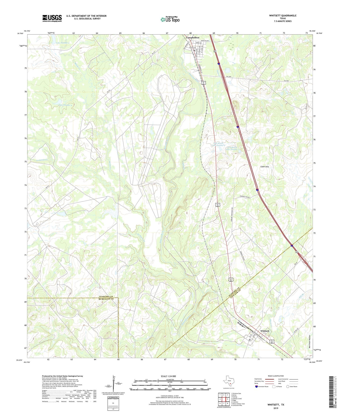
2022 topographic map quadrangle Whitsett in the state of Texas. Scale: 1:24000. Based on the newly updated USGS 7.5' US Topo map series, this map is in the following counties: Atascosa, Live Oak, McMullen. The map contains contour data, water features, and other items you are used to seeing on USGS maps, but also has updated roads and other features. This is the next generation of topographic maps. Printed on high-quality waterproof paper with UV fade-resistant inks.
Quads adjacent to this one:
West: Caballos Creek
Northwest: Christine East
North: McCoy
Northeast: Fashing
East: Peggy
Southeast: Comanche Hills
South: Willow Hollow Tank
Southwest: Crowther
This map covers the same area as the classic USGS quad with code o28098f3.
Contains the following named places: 74 Ranch Dam Number 3, 74 Ranch Dam Number 4, 78008, Campbellton, Campbellton Post Office, La Parita Creek, Lake Number 3, Lake Number 4, Lipan Creek, Lipan Hills, Metate Creek, Salt Branch, Seventy-Four Ranch, Tom Ranch, Tom Ranch Lake Number 1, Tom Ranch Lake Number 1 Dam, Tom Ranch Lake Number 2, Tom Ranch Lake Number 2 Dam, Whitsett, Whitsett Post Office