MyTopo
Wilson Ranch Texas US Topo Map
Couldn't load pickup availability
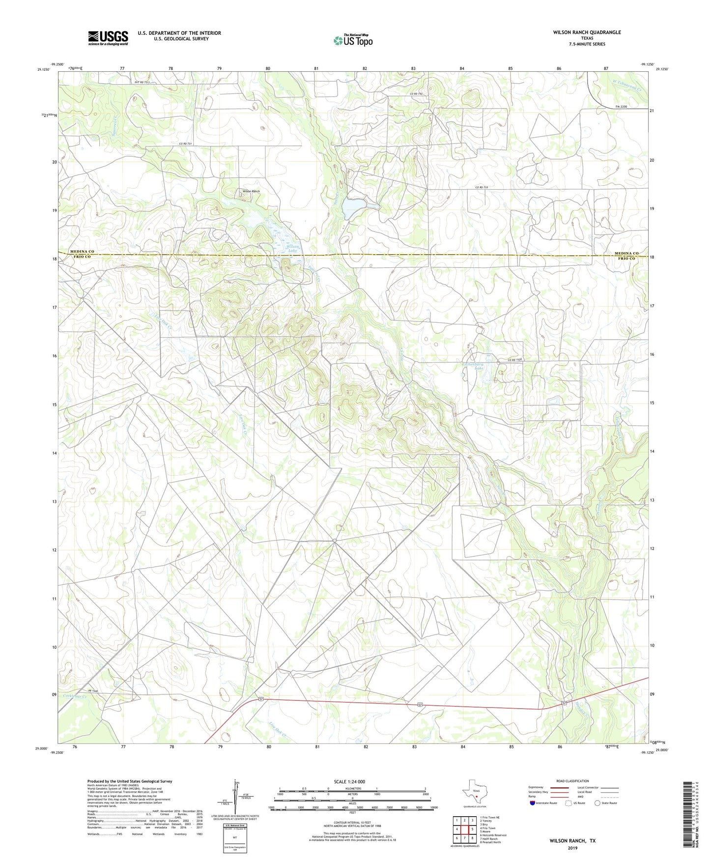
2019 topographic map quadrangle Wilson Ranch in the state of Texas. Scale: 1:24000. Based on the newly updated USGS 7.5' US Topo map series, this map is in the following counties: Frio, Medina. The map contains contour data, water features, and other items you are used to seeing on USGS maps, but also has updated roads and other features. This is the next generation of topographic maps. Printed on high-quality waterproof paper with UV fade-resistant inks.
Quads adjacent to this one:
West: Frio Town
Northwest: Frio Town NE
North: Yancey
Northeast: Biry
East: Moore
Southeast: Pearsall North
South: Halff Ranch
Southwest: Holcomb Reservoir
Contains the following named places: Briggs Windmill, Eschenburg Lake, Eschenburg Lake Dam, Javelin Windmill, Live Oak Windmill, Seco Creek, Slaughter Windmill, Spur Windmill, Squirrel Creek, Tacho Windmill, Tehuacana Creek, Wilson Lake, Wilson Lake Dam, Wilson Ranch