MyTopo
Halff Ranch Texas US Topo Map
Couldn't load pickup availability
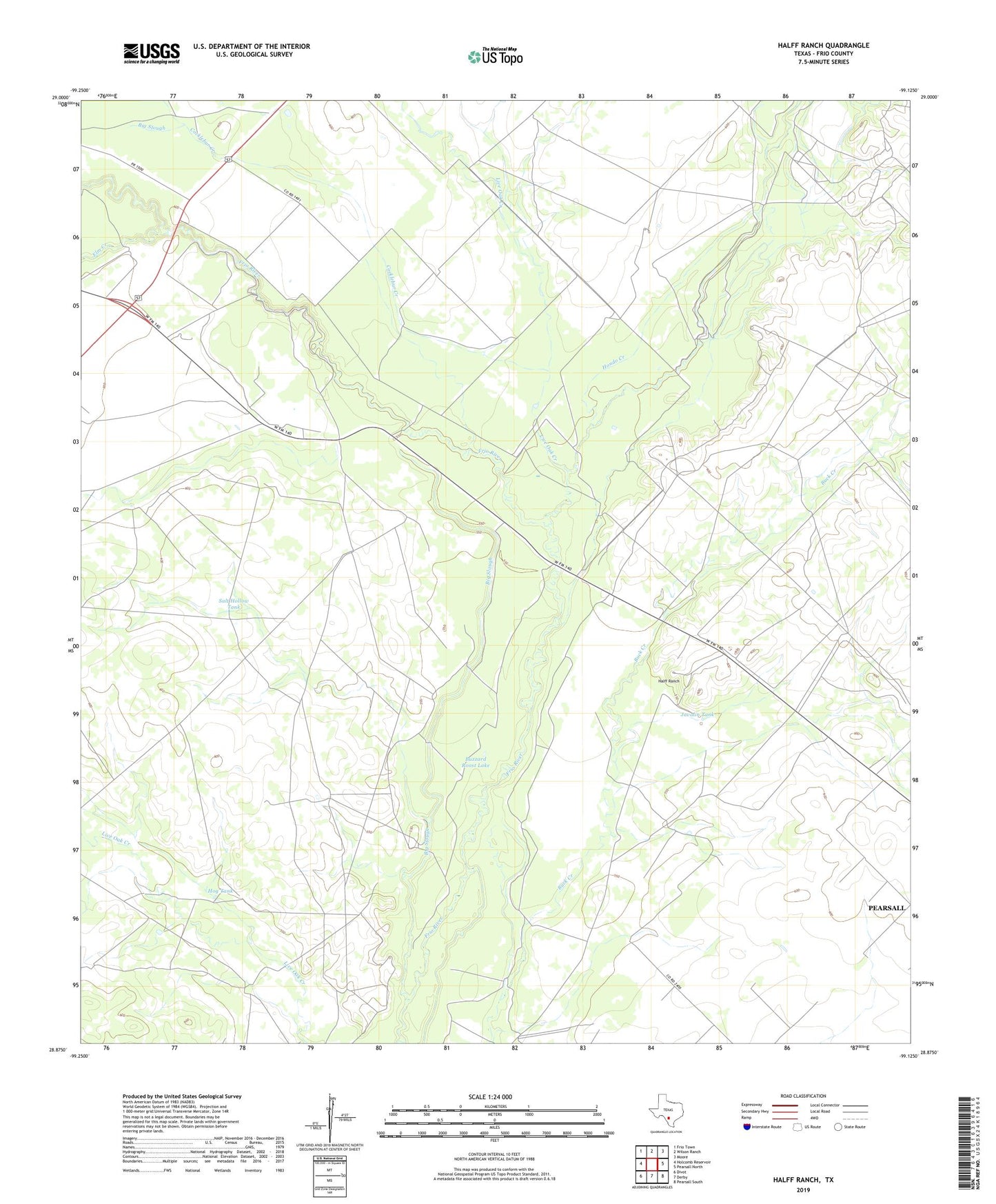
2022 topographic map quadrangle Halff Ranch in the state of Texas. Scale: 1:24000. Based on the newly updated USGS 7.5' US Topo map series, this map is in the following counties: Frio. The map contains contour data, water features, and other items you are used to seeing on USGS maps, but also has updated roads and other features. This is the next generation of topographic maps. Printed on high-quality waterproof paper with UV fade-resistant inks.
Quads adjacent to this one:
West: Holcomb Reservoir
Northwest: Frio Town
North: Wilson Ranch
Northeast: Moore
East: Pearsall North
Southeast: Pearsall South
South: Derby
Southwest: Divot
This map covers the same area as the classic USGS quad with code o28099h2.
Contains the following named places: Barrel Windmill, Big Slough, Bob Smith Windmill, Buzzard Roost Lake, Buzzard Roost Windmill, Cocklebur Creek, Cocklebur Windmill, Cude Crossing Windmill, Cude Windmill, Dove Tank, El Rancho Quien Sabe, Elm Creek, Forest Windmill, H and B Ranch, Halff Ranch, Hog Tank, Hondo Creek, Hunters Camp Windmill, Javalin Tank, Javalin Windmill, Jewel Lake, Jewel Lake Windmill, John Gray Windmill, Johnson Ranch Windmill, Little Field Windmill, Little Steel Windmill, Live Oak Creek, Number Five Windmill, Number Three Windmill, Pranglin Windmill, Rio Frio Ranch, Robledo Windmill, Rockhole Windmill, Salt Hollow Tank, Salty Windmill, Stoker Ranch, Thompson Ranch, Tortuga Windmill, Twin Windmills, West Slough Windmill, ZIP Code: 78061