MyTopo
Wolf Mountain Texas US Topo Map
Couldn't load pickup availability
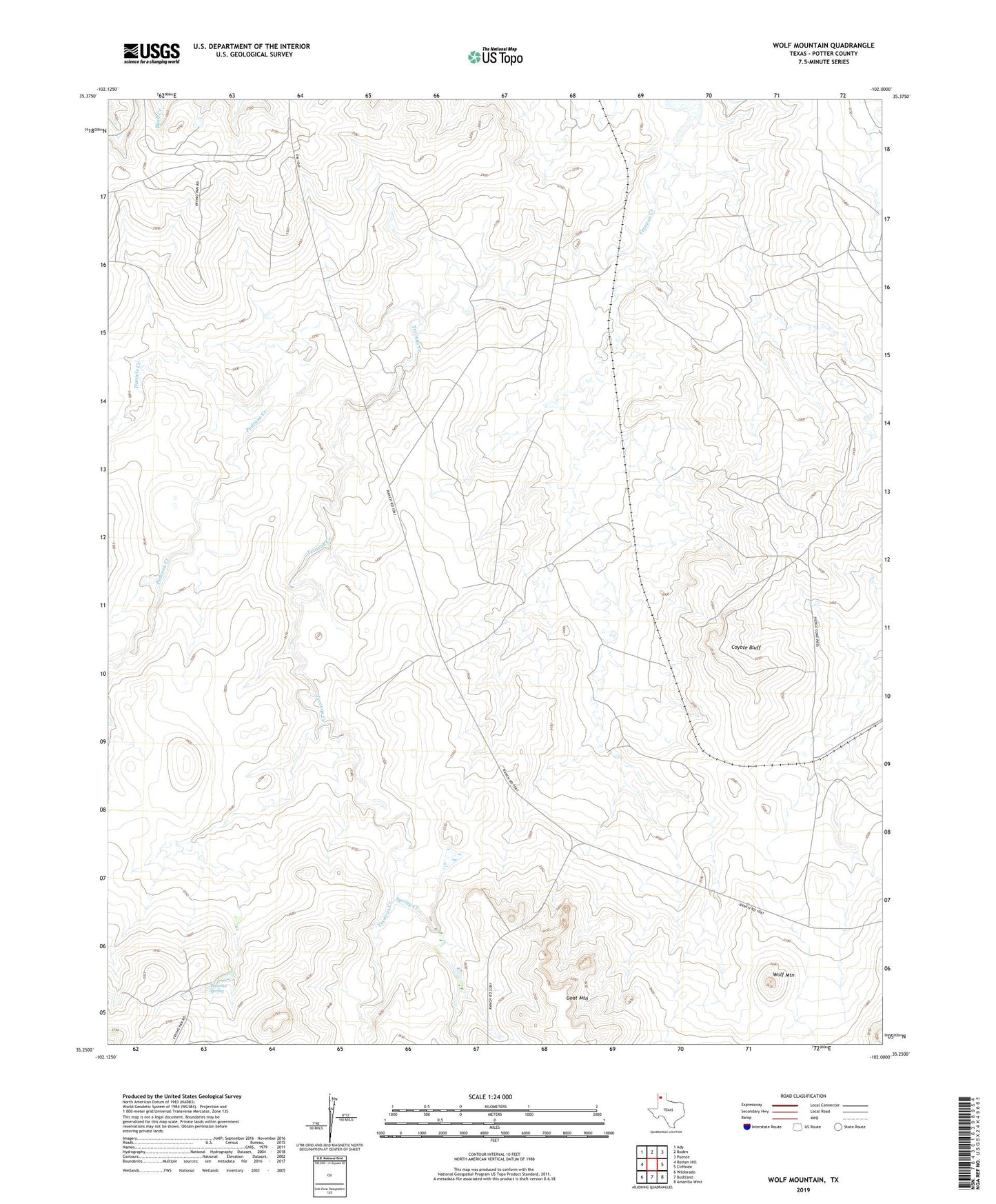
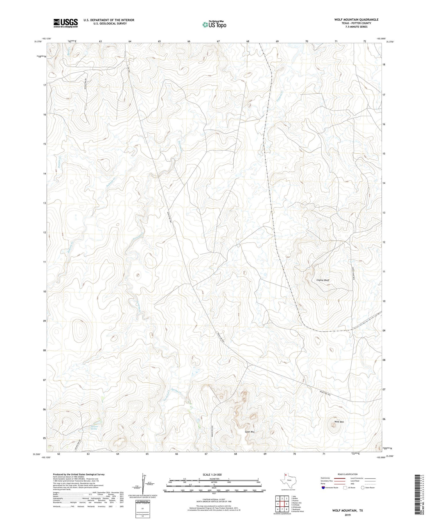
2019 topographic map quadrangle Wolf Mountain in the state of Texas. Scale: 1:24000. Based on the newly updated USGS 7.5' US Topo map series, this map is in the following counties: Potter. The map contains contour data, water features, and other items you are used to seeing on USGS maps, but also has updated roads and other features. This is the next generation of topographic maps. Printed on high-quality waterproof paper with UV fade-resistant inks.
Quads adjacent to this one:
West: Rotten Hill
Northwest: Ady
North: Boden
Northeast: Puente
East: Cliffside
Southeast: Amarillo West
South: Bushland
Southwest: Wildorado
Contains the following named places: Coyote Bluff, Daniels Creek, Fryingpan Ranch, Pedrosa Creek, Ranch Marsh Lake, Spring Creek, Tecovas Spring, Wolf Mountain, Word Ranch