MyTopo
Refugio Texas US Topo Map
Couldn't load pickup availability
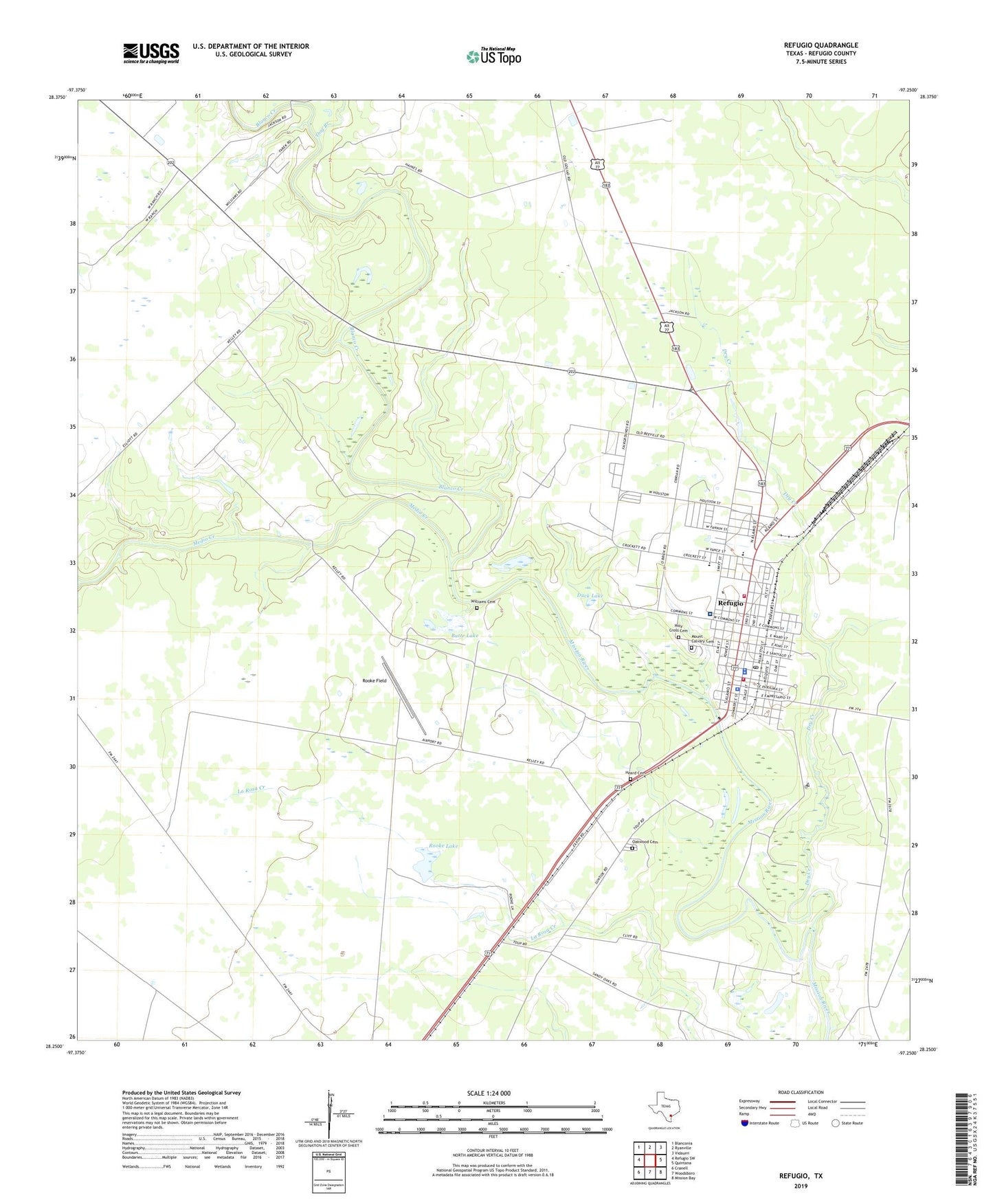
2022 topographic map quadrangle Refugio in the state of Texas. Scale: 1:24000. Based on the newly updated USGS 7.5' US Topo map series, this map is in the following counties: Refugio. The map contains contour data, water features, and other items you are used to seeing on USGS maps, but also has updated roads and other features. This is the next generation of topographic maps. Printed on high-quality waterproof paper with UV fade-resistant inks.
Quads adjacent to this one:
West: Refugio SW
Northwest: Blanconia
North: Ryanville
Northeast: Vidaurri
East: Quintana
Southeast: Mission Bay
South: Woodsboro
Southwest: Cranell
This map covers the same area as the classic USGS quad with code o28097c3.
Contains the following named places: Blanco Creek, Butte Lake, Church of Christ, Dog Branch, Dry Creek, Duck Lake, Episcopal Church of the Ascension, First Baptist Church, First Temple Assembly of God Church, Heard Cemetery, Holy Cross Cemetery, KZTX-FM (Refugio), Lions City Park, Medio Creek, Melon Creek Oil and Gas Field, Mission River Oil and Gas Field, Mount Calvary Cemetery, Mount Pilgrim Baptist Church, Oakwood Cemetery, Presbyterian Church, Refugio, Refugio City Hall, Refugio City Park, Refugio County Constable's Office Precinct 1, Refugio County Constable's Office Precinct 2, Refugio County Jail, Refugio County Memorial Hospital, Refugio County Museum, Refugio County Sheriff's Office, Refugio Fire Department, Refugio High School, Refugio Middle School, Refugio Oil Field, Refugio Police Department, Refugio Police Department Annex and Training, Refugio Post Office, Refugio Volunteer Fire Department, Rooke Field, Rooke Lake, Rooke Lake Dam, Stricklin Primary School, Town of Refugio, Trinity Lutheran Church, Union Baptist Church, Williams Cemetery