MyTopo
Wide Hollow Reservoir Utah US Topo Map
Couldn't load pickup availability
Also explore the Wide Hollow Reservoir Forest Service Topo of this same quad for updated USFS data
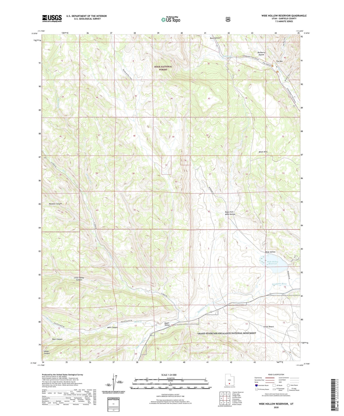
2023 topographic map quadrangle Wide Hollow Reservoir in the state of Utah. Scale: 1:24000. Based on the newly updated USGS 7.5' US Topo map series, this map is in the following counties: Garfield. The map contains contour data, water features, and other items you are used to seeing on USGS maps, but also has updated roads and other features. This is the next generation of topographic maps. Printed on high-quality waterproof paper with UV fade-resistant inks.
Quads adjacent to this one:
West: Griffin Point
Northwest: Barker Reservoir
North: Posy Lake
Northeast: Roger Peak
East: Escalante
Southeast: Dave Canyon
South: Canaan Creek
Southwest: Upper Valley
This map covers the same area as the classic USGS quad with code o37111g6.
Contains the following named places: Birch Creek, Black Hills, Buck Hollow, Bullberry Hollow, Deer Canyon, East Fork North Creek, Escalante Petrified Forest Campground, Escalante Petrified Forest State Park, Griffin Ranch, Hall Ranch, Heaps Canyon, Heaps Ranch, Little Desert, Little Valley Canyon, Lost Creek, Main Canyon, Meadow Canyon, North Creek, Riddle Ranch, Right Fork Wide Hollow, Roundy Ranch, Skull Spring, The Box, Upper Valley, Upper Valley Creek, Wide Hollow, Wide Hollow Dam, Wide Hollow Reservoir