MyTopo
Navajo Point Utah US Topo Map
Couldn't load pickup availability
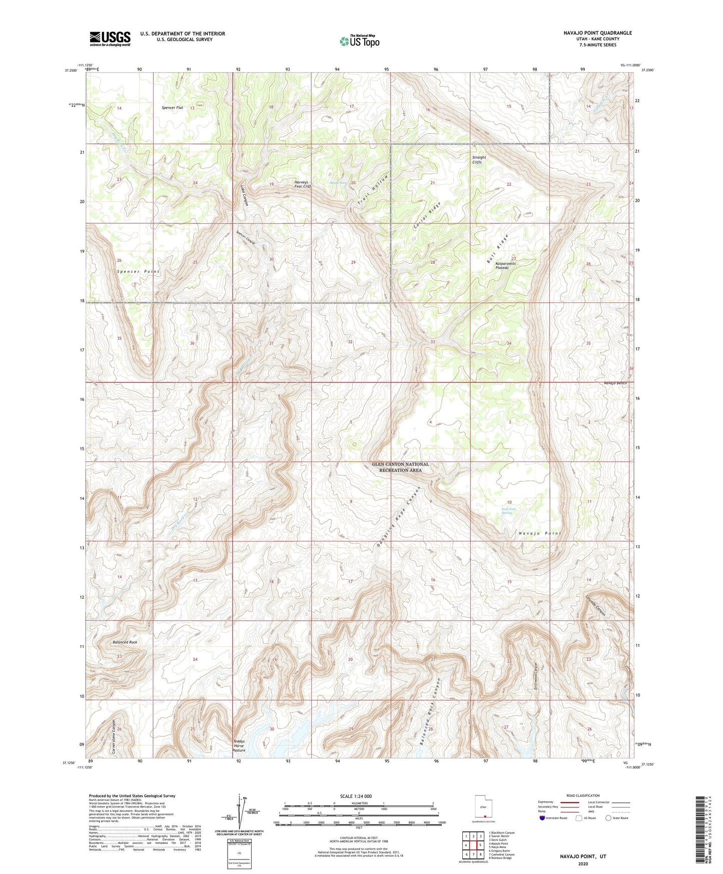
2023 topographic map quadrangle Navajo Point in the state of Utah. Scale: 1:24000. Based on the newly updated USGS 7.5' US Topo map series, this map is in the following counties: Kane. The map contains contour data, water features, and other items you are used to seeing on USGS maps, but also has updated roads and other features. This is the next generation of topographic maps. Printed on high-quality waterproof paper with UV fade-resistant inks.
Quads adjacent to this one:
West: Mazuki Point
Northwest: Blackburn Canyon
North: Sooner Bench
Northeast: Davis Gulch
East: Nasja Mesa
Southeast: Rainbow Bridge
South: Cathedral Canyon
Southwest: Gregory Butte
This map covers the same area as the classic USGS quad with code o37111b1.
Contains the following named places: Balanced Rock, Balanced Rock Canyon, Bull Ridge, Corral Ridge, Dangling Rope Canyon, Driftwood Canyon, Dry Rock Creek, East End Spring, Harveys Fear Cliff, Lake Canyon, Maple Seep, Navajo Bench, Navajo Point, Spencer Canyon, Spencer Flat, Spencer Point, Teddys Horse Pasture, Trail Hollow