MyTopo
King Mesa Utah US Topo Map
Couldn't load pickup availability
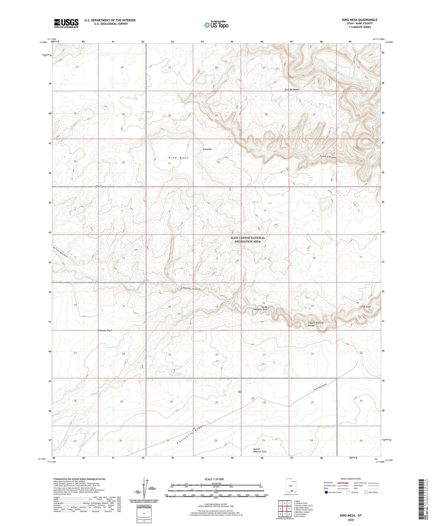
2023 topographic map quadrangle King Mesa in the state of Utah. Scale: 1:24000. Based on the newly updated USGS 7.5' US Topo map series, this map is in the following counties: Kane. The map contains contour data, water features, and other items you are used to seeing on USGS maps, but also has updated roads and other features. This is the next generation of topographic maps. Printed on high-quality waterproof paper with UV fade-resistant inks.
Quads adjacent to this one:
West: Big Hollow Wash
Northwest: Egypt
North: Scorpion Gulch
Northeast: Stevens Canyon North
East: Stevens Canyon South
Southeast: Davis Gulch
South: Sooner Bench
Southwest: Blackburn Canyon
This map covers the same area as the classic USGS quad with code o37111d1.
Contains the following named places: Chimney Rock, Cliff Arch, Coyote Natural Bridge, Dry Fork Coyote Gulch, Ezra Mc Bench, Fools Canyon, Fortymile Ridge, Gates Tank, Hurricane Wash, Jacob Hamblin Arch, King Mesa, Les George Point, Scorpion, Sunset Natural Arch