MyTopo
Blind Springs Utah US Topo Map
Couldn't load pickup availability
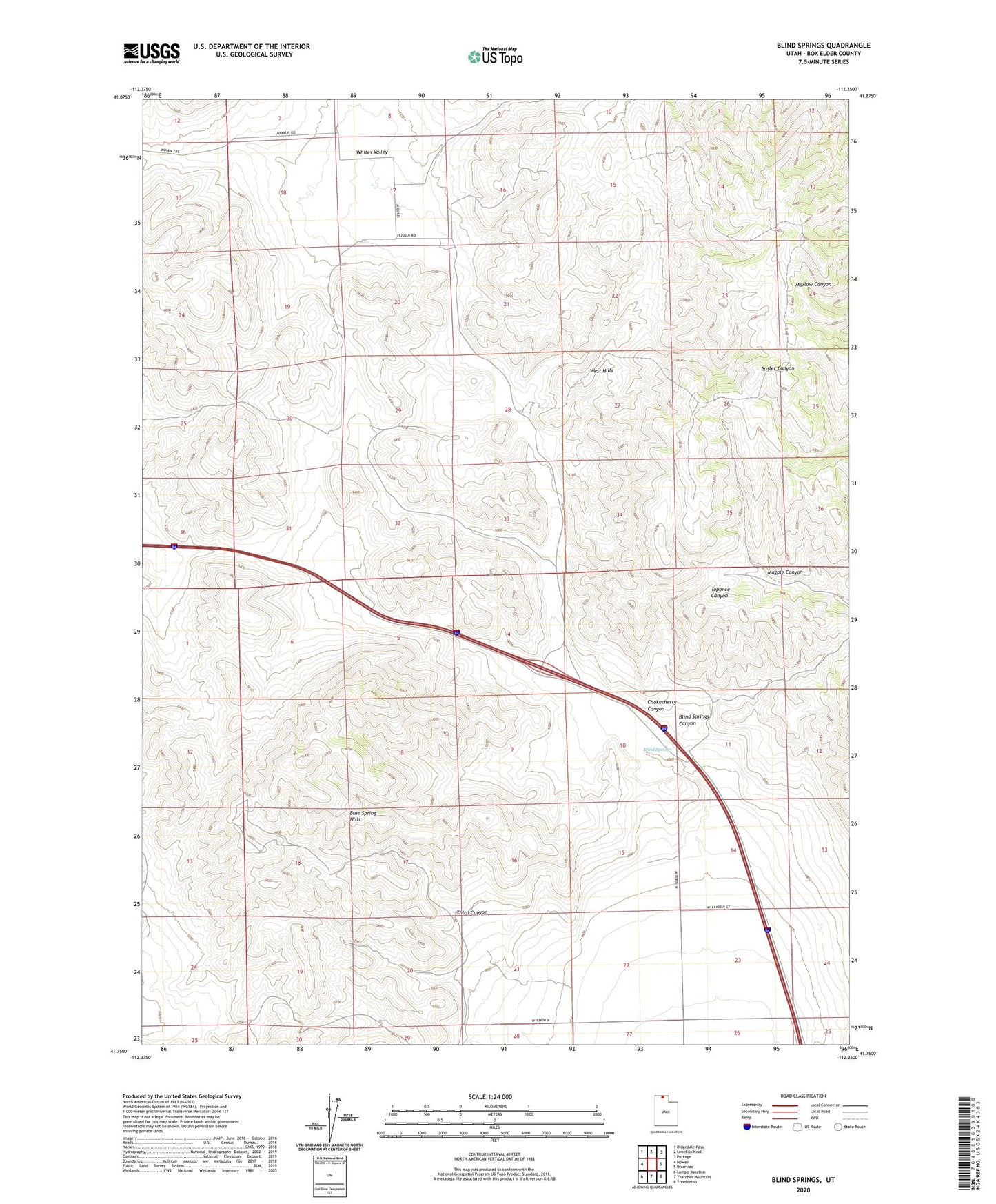
2020 topographic map quadrangle Blind Springs in the state of Utah. Scale: 1:24000. Based on the newly updated USGS 7.5' US Topo map series, this map is in the following counties: Box Elder. The map contains contour data, water features, and other items you are used to seeing on USGS maps, but also has updated roads and other features. This is the next generation of topographic maps. Printed on high-quality waterproof paper with UV fade-resistant inks.
Quads adjacent to this one:
West: Howell
Northwest: Ridgedale Pass
North: Limekiln Knoll
Northeast: Portage
East: Riverside
Southeast: Tremonton
South: Thatcher Mountain
Southwest: Lampo Junction
Contains the following named places: Blind Springs, Blind Springs Canyon, Chokecherry Canyon, Magpie Canyon, Third Canyon, Whites Valley, ZIP Code: 84337