MyTopo
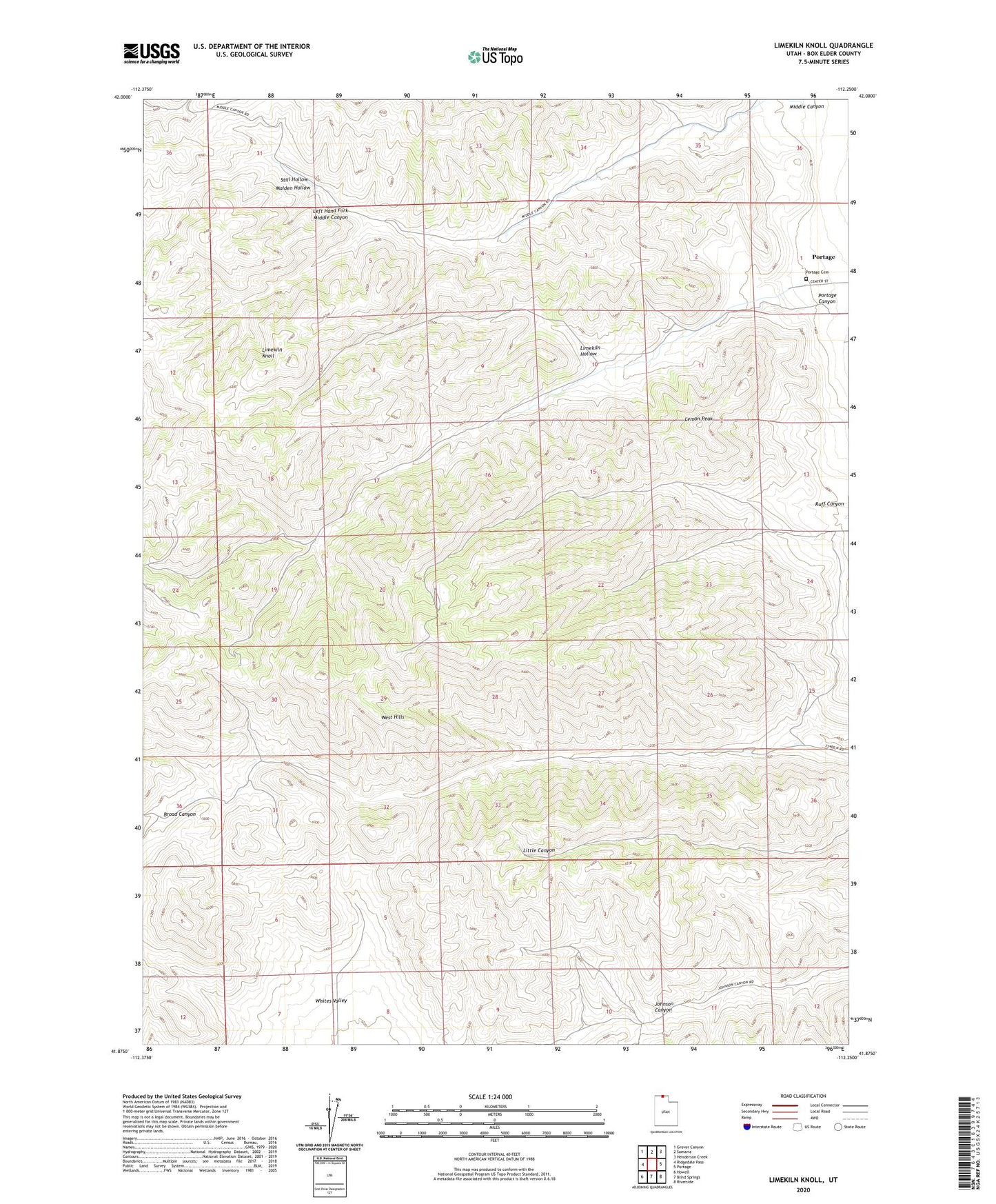
Limekiln Knoll Utah US Topo Map
Couldn't load pickup availability
2023 topographic map quadrangle Limekiln Knoll in the state of Utah. Scale: 1:24000. Based on the newly updated USGS 7.5' US Topo map series, this map is in the following counties: Box Elder. The map contains contour data, water features, and other items you are used to seeing on USGS maps, but also has updated roads and other features. This is the next generation of topographic maps. Printed on high-quality waterproof paper with UV fade-resistant inks.
Quads adjacent to this one:
West: Ridgedale Pass
Northwest: Grover Canyon
North: Samaria
Northeast: Henderson Creek
East: Portage
Southeast: Riverside
South: Blind Springs
Southwest: Howell
This map covers the same area as the classic USGS quad with code o41112h3.
Contains the following named places: Left Hand Fork Middle Canyon, Lemon Peak, Limekiln Hollow, Limekiln Knoll, Maiden Hollow, Middle Canyon, Portage Canyon, Portage Cemetery, Ruff Canyon, Still Hollow, West Hills, ZIP Code: 84331