MyTopo
Bogart Canyon Utah US Topo Map
Couldn't load pickup availability
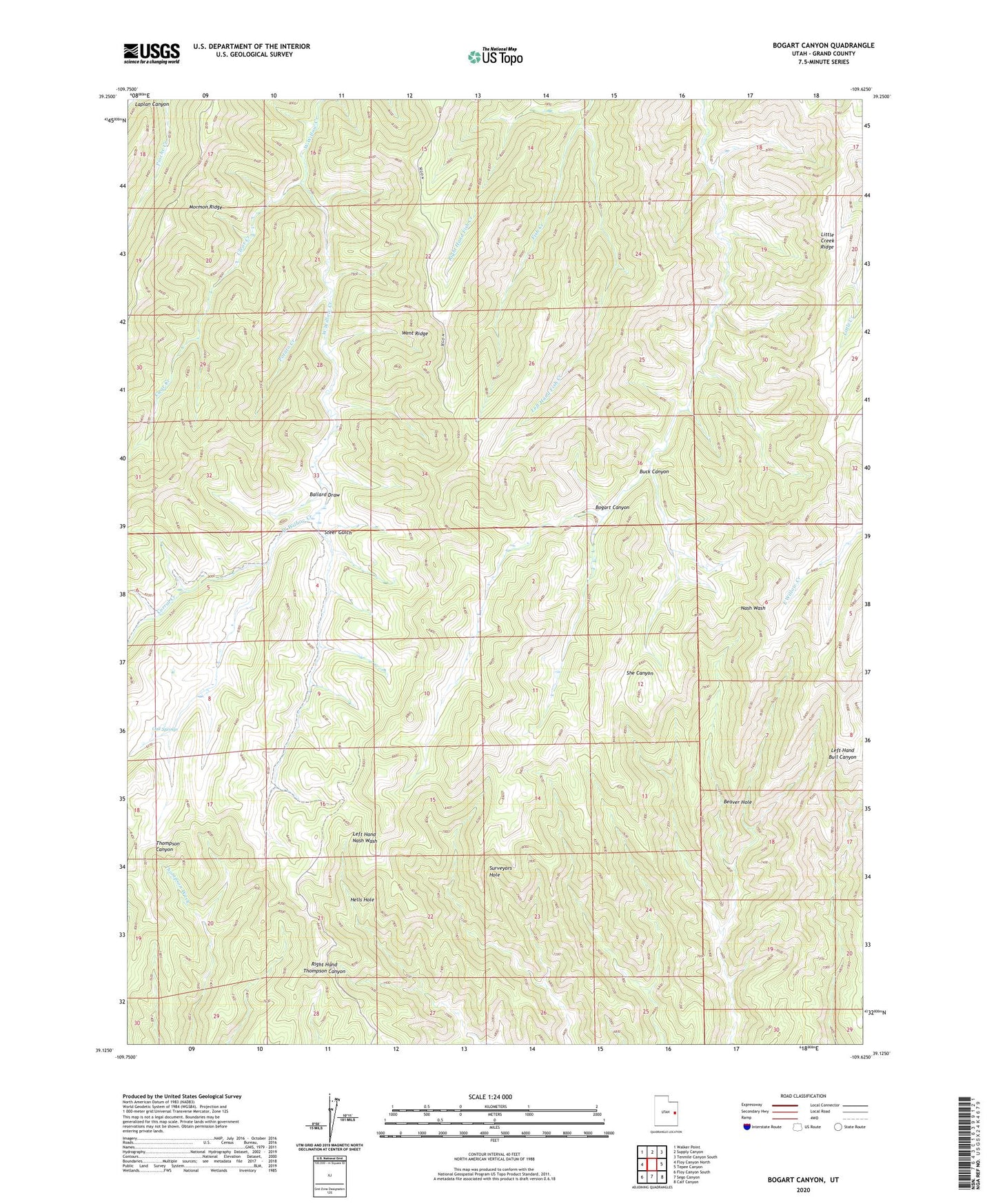
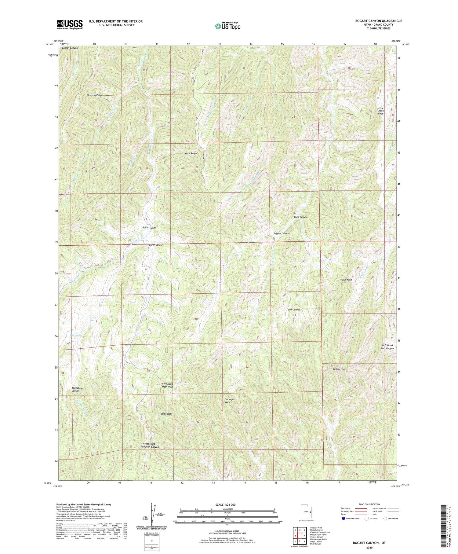
2020 topographic map quadrangle Bogart Canyon in the state of Utah. Scale: 1:24000. Based on the newly updated USGS 7.5' US Topo map series, this map is in the following counties: Grand. The map contains contour data, water features, and other items you are used to seeing on USGS maps, but also has updated roads and other features. This is the next generation of topographic maps. Printed on high-quality waterproof paper with UV fade-resistant inks.
Quads adjacent to this one:
West: Floy Canyon North
Northwest: Walker Point
North: Supply Canyon
Northeast: Tenmile Canyon South
East: Tepee Canyon
Southeast: Calf Canyon
South: Sego Canyon
Southwest: Floy Canyon South
Contains the following named places: Ballard Draw, Beaver Hole, Bogart Canyon, Buck Canyon, Clear Creek, Corral Creek, Hells Hole, Left Hand Fish Creek, Oak Springs, Potato Creek, Right Hand Fish Creek, Steer Gulch, Surveyors Hole, The Pines