MyTopo
Myton Utah US Topo Map
Couldn't load pickup availability
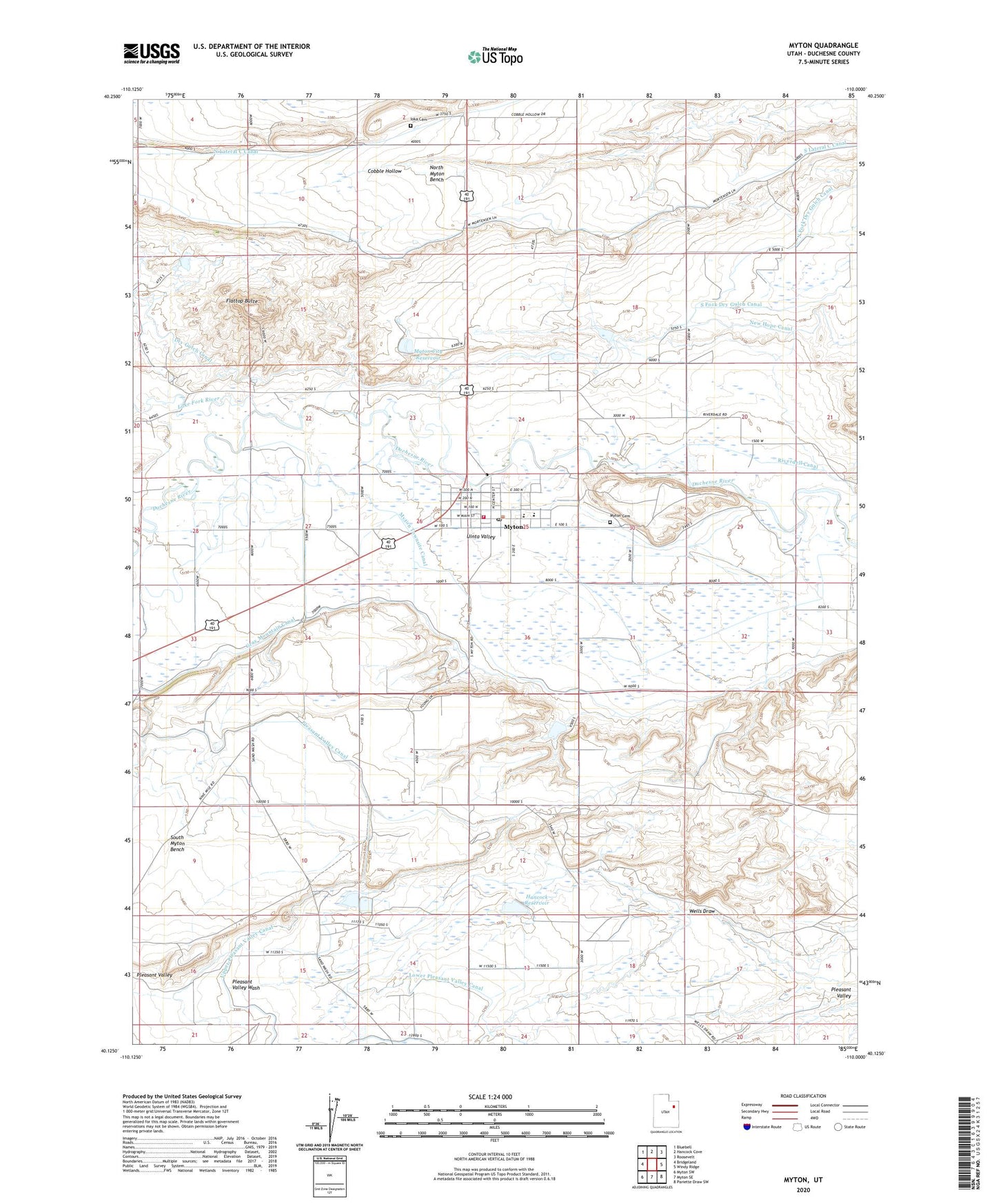
2023 topographic map quadrangle Myton in the state of Utah. Scale: 1:24000. Based on the newly updated USGS 7.5' US Topo map series, this map is in the following counties: Duchesne. The map contains contour data, water features, and other items you are used to seeing on USGS maps, but also has updated roads and other features. This is the next generation of topographic maps. Printed on high-quality waterproof paper with UV fade-resistant inks.
Quads adjacent to this one:
West: Bridgeland
Northwest: Bluebell
North: Hancock Cove
Northeast: Roosevelt
East: Windy Ridge
Southeast: Pariette Draw SW
South: Myton SE
Southwest: Myton SW
This map covers the same area as the classic USGS quad with code o40110b1.
Contains the following named places: City of Myton, Community Presbyterian Church, Dry Gulch Canal, Flattop Butte, Hancock Dam, Hancock Reservoir, Ioka Cemetery, Lake Fork River, Myton, Myton Cemetery, Myton City Reservoir, Myton Elementary School, Myton Fire Department, Myton Post Office, Myton Pumping Station, New Hope Canal, North Lateral C Canal, North Myton Bench, Pleasant Valley Canal, Riverdell Canal, South Lateral C Canal, South Myton Bench, The Church of Jesus Christ of Latter Day Saints, Upper Pleasant Valley Canal, Wells Draw