MyTopo
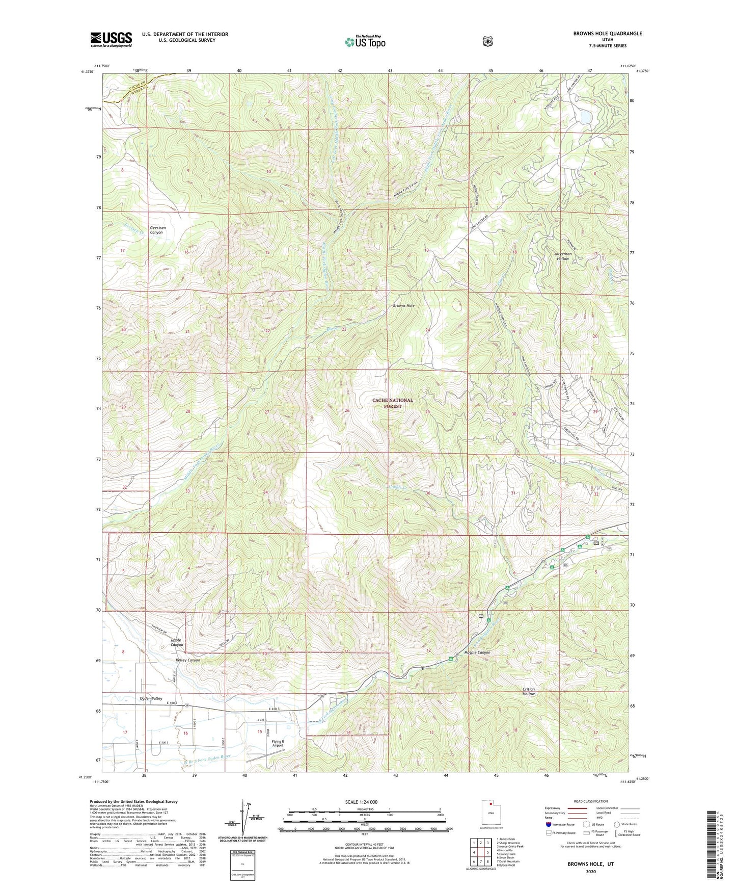
Browns Hole Utah US Topo Map
Couldn't load pickup availability
2020 topographic map quadrangle Browns Hole in the state of Utah. Scale: 1:24000. Based on the newly updated USGS 7.5' US Topo map series, this map is in the following counties: Weber, Cache. The map contains contour data, water features, and other items you are used to seeing on USGS maps, but also has updated roads and other features. This is the next generation of topographic maps. Printed on high-quality waterproof paper with UV fade-resistant inks.
Quads adjacent to this one:
West: Huntsville
Northwest: James Peak
North: Sharp Mountain
Northeast: Monte Cristo Peak
East: Causey Dam
Southeast: Bybee Knoll
South: Durst Mountain
Southwest: Snow Basin
Contains the following named places: Botts Flat Picnic Ground, Browns Hole, Camp Beaver, Cobble Creek, Critian Hollow, Elk Creek, Evergreen Park, Flying R Airport, Hawthorne Campground, Hobble Campground, Huntsville Hollow, Huntsville South Ditch, Kelley Canyon, Left Fork Middle Fork Ogden River, Magpie Canyon, Magpie Picnic Ground, Maple Canyon, Meadows Campground, Meadows Picnic Ground, Mountain Canal, Mountain Valley Meadows, Ogden Valley Canal, Ogden Valley Division, Perception Park Campground, Right Fork Middle Fork Ogden River, South Fork Ogden River, South Fork Picnic Ground, South Fork Ranchettes, Willows Park Picnic Ground