MyTopo
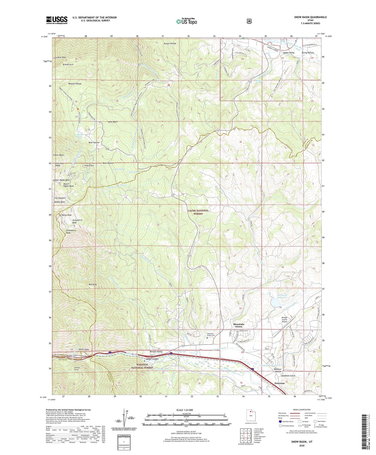
Snow Basin Utah US Topo Map
Couldn't load pickup availability
Also explore the Snow Basin Forest Service Topo of this same quad for updated USFS data
2023 topographic map quadrangle Snow Basin in the state of Utah. Scale: 1:24000. Based on the newly updated USGS 7.5' US Topo map series, this map is in the following counties: Morgan, Weber, Davis. The map contains contour data, water features, and other items you are used to seeing on USGS maps, but also has updated roads and other features. This is the next generation of topographic maps. Printed on high-quality waterproof paper with UV fade-resistant inks.
Quads adjacent to this one:
West: Ogden
Northwest: North Ogden
North: Huntsville
Northeast: Browns Hole
East: Durst Mountain
Southeast: Morgan
South: Peterson
Southwest: Kaysville
This map covers the same area as the classic USGS quad with code o41111b7.
Contains the following named places: Bear Hollow, Bear Spring, Bear Wallow, Bohman Hollow, Breeze Arch, Chicken Spring Creek, Cottonwood Creek, De Moisy Peak, Deadman Gulch, Devils Gate, Dry Creek, East Fork Wheeler Creek, Gateway, Gateway Tunnel, Gordon Creek, Green Pond, Hawkins Creek, Hawkins Spring, Hill Air Force Base Recreation Area, Huntsville Reservoir, Huntsville South Branch Canal, Jacobs Creek, Jefferson Hunt Campground, Maples Picnic Area, Middle Bowl, Middle Fork Wheeler Creek, Middle Peak, Morgan County Airport, Morgan County Community Church, Morgan Valley, Mount Ogden Bowl, Mountain Green, Mountain Green Cemetery, Mountain Green Census Designated Place, Mountain Green Fire Department, Northwest Bench Ditch, Northwest Reservoir, Sardine Peak, Snow Basin, Snow Basin Heliport, Snow Basin Ski Area, South Arm Campground, South Branch South Fork Ogden River, Spring Hollow, Strawberry Bowl, Strawberry Creek, Strawberry Mine, Strawberry Peak, Tatterson Creek, The Needles, Trout Springs, Valley Lake Estates, Warner Spring, Wheeler Spring, Wildcat Campground, Wildcat Run, Wilkinson Reservoir, Willow Spring